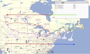
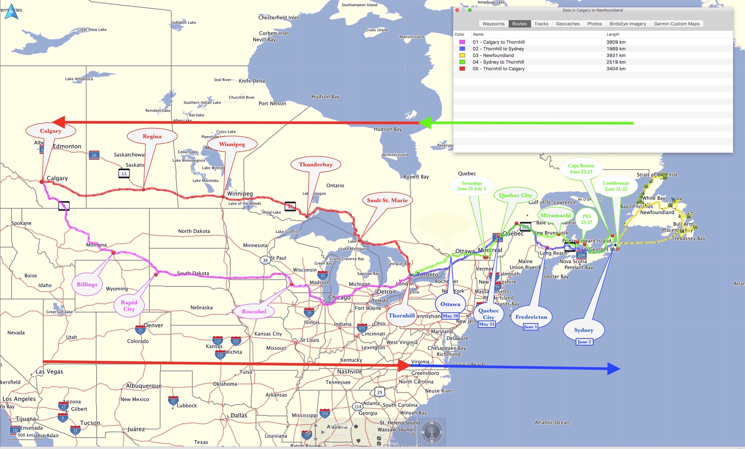
This road trip began on May 18th and ended July 15th 2016. The route took us from Calgary to St. John’s Newfoundland and back over three legs:
- Fly out to Calgary to pick up my Dad, and drive back to Thornhill, with stops in Billings Montana, Rapid City South Dakota and Boscobel Wisconsin.
- Continue to Newfoundland, with stops in Ottawa, Cape Breton, PEI, and the Eastern Townships.
- Drive back to Calgary and then I’ll fly back home.
Blog Entries:
-
Road Trip
In the next couple of days I’ll begin a road trip; a fairly extensive one covering some 16,000 km over 2 months. The route takes us from Calgary to St. John’s Newfoundland and back. There are three legs to the trip: I’ll be back July 15th, when I will spend the remainder of the summer…
-
Starting Point
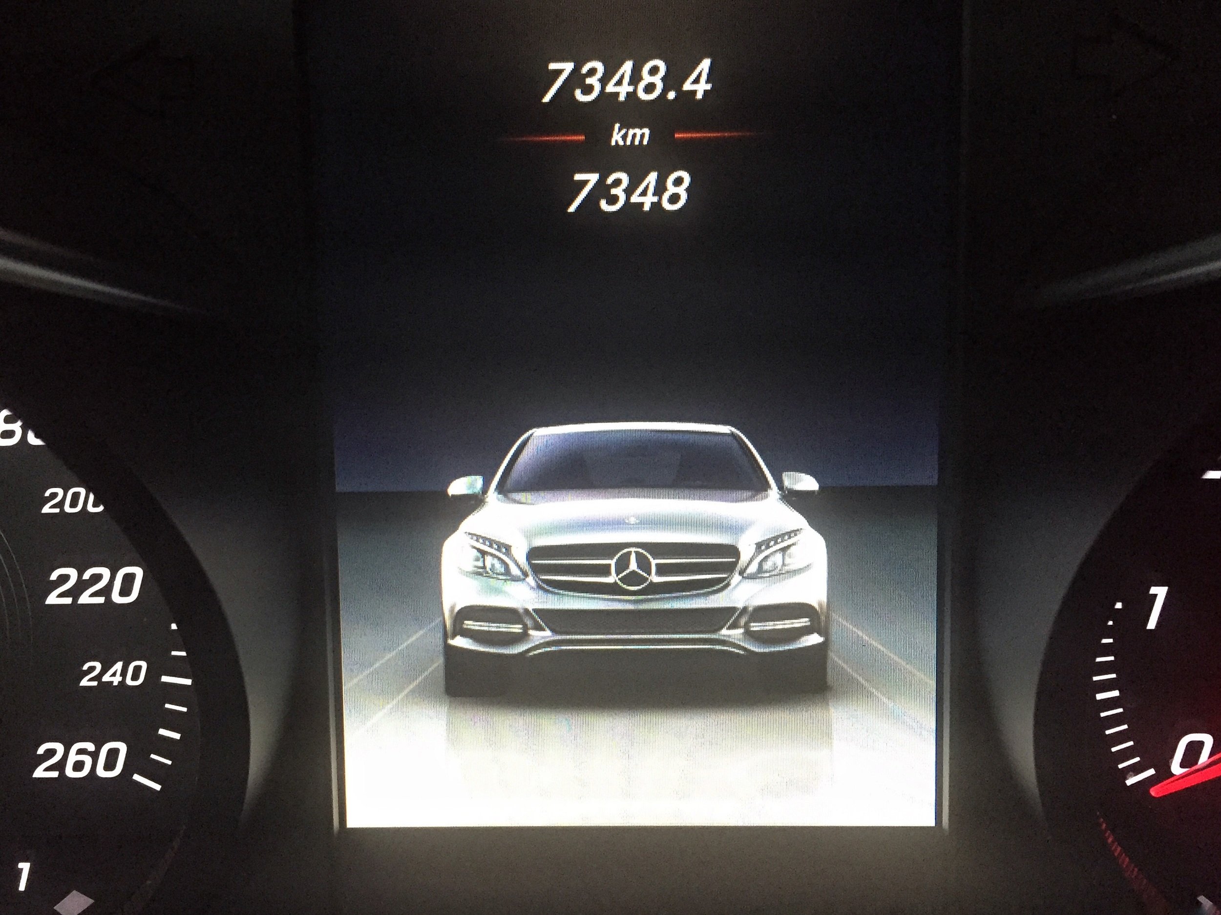
The odometer reads 7348.4 km
-
Departure
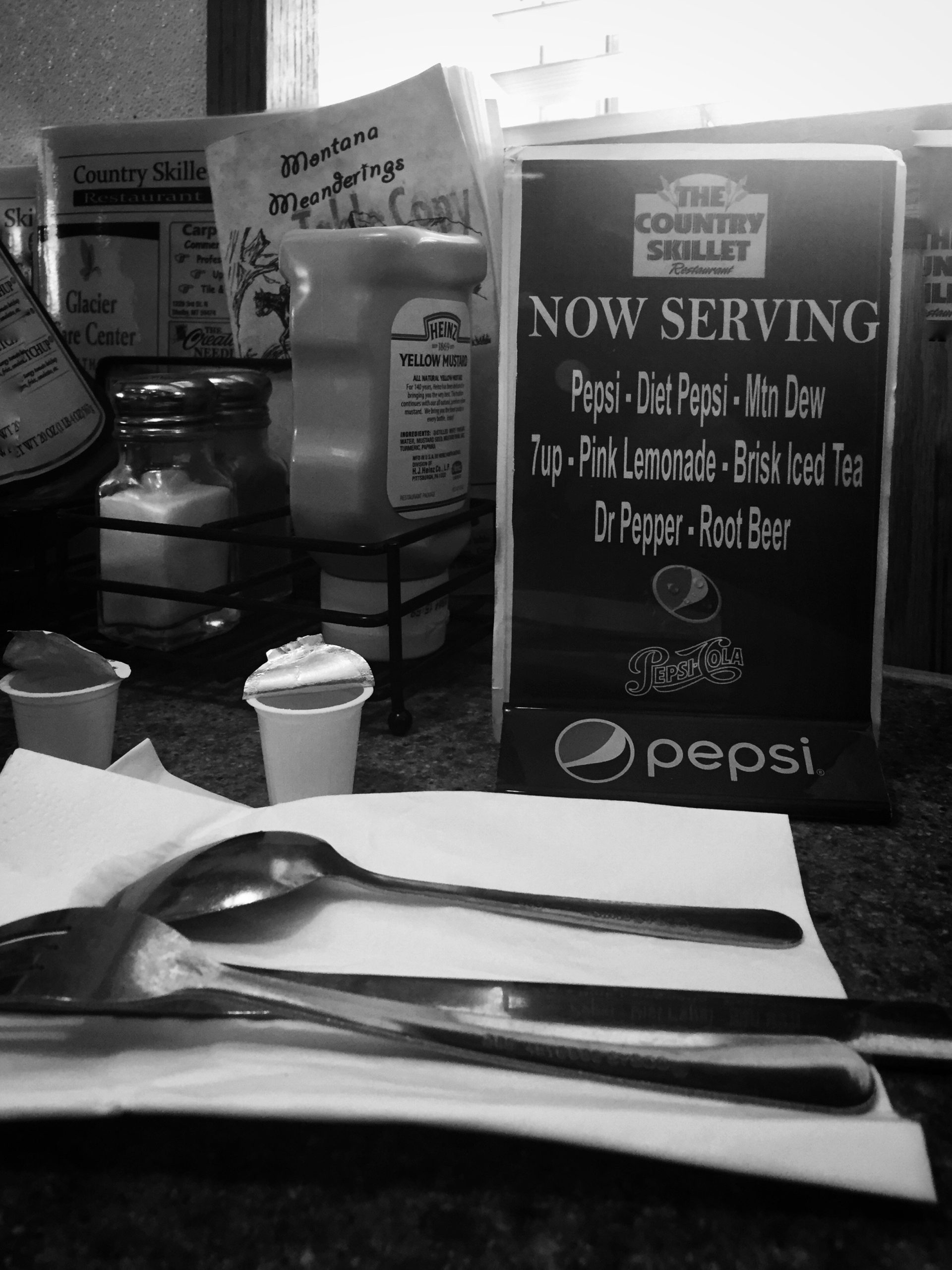
We left Calgary around 8:00AM and arrived in Billings at around 5:00PM covering about 850km. After crossing the border we stopped for lunch at the Country Skillet in Shelby Montana. A rather typical diner, attached to a gas station and casino. Hamburgers started at $7.75. Coffee was endless for $1.90.
-
Little Big Horn
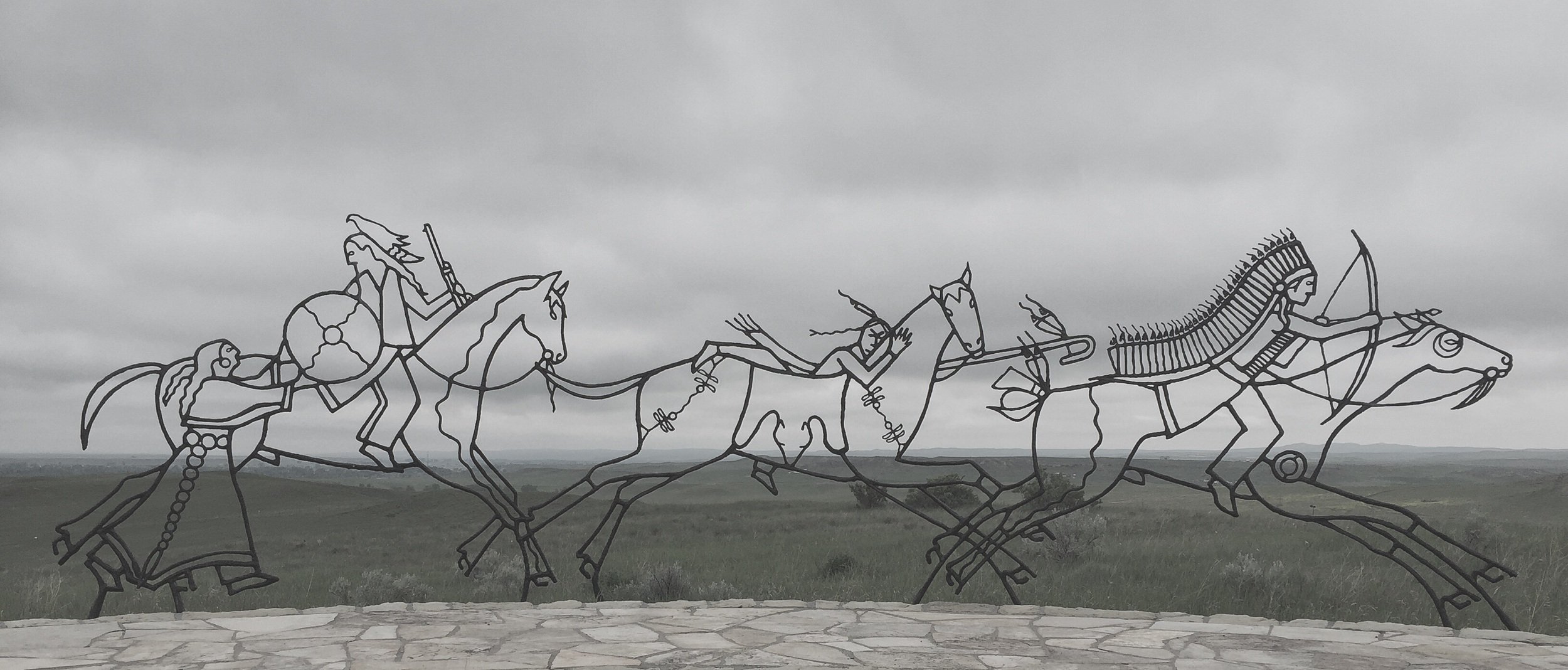
We visited the battle field on Saturday. Getting there early, we avoided the rush which made it a pleasant visit. Next to the memorial to the fallen US Cavalery Soldiers is one for the Native Americans who died defending their homes and families. While the Natives won the battle, they lost the war. After defeat,…
-
Mount Rushmore
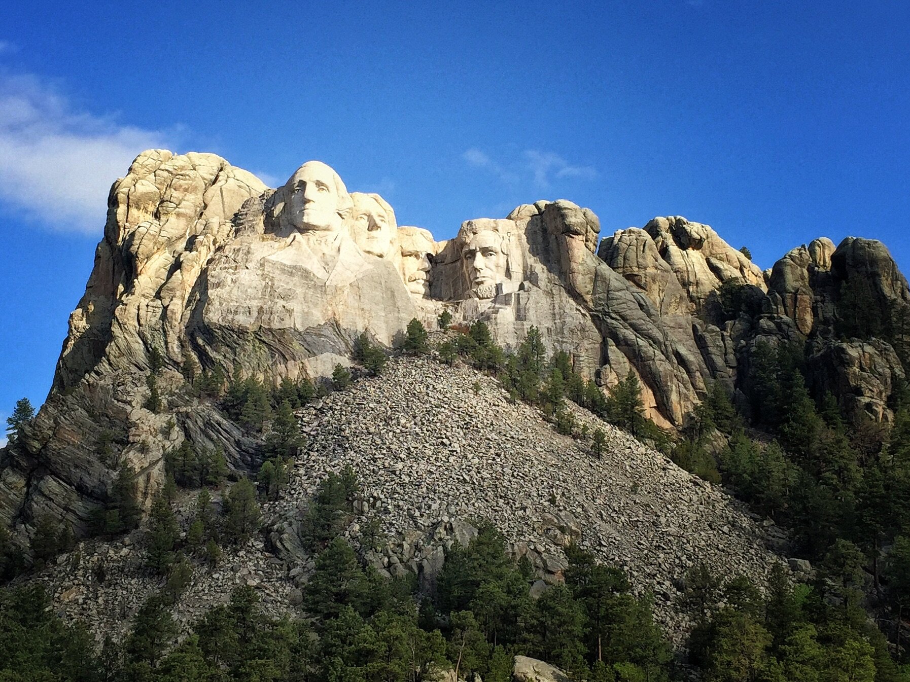
After spending the night in Rapid City South Dakota, Sunday morning we drove to Mount Rushmore. Although entrance is free, parking is $11.- However, as we arrived before 8:00AM the entrance gate was unoccupied, and thus all was free. We walked the approximately 1 kilometre Presidential Trail that is more precisely in part a wooden…
-
Mount Rushmore
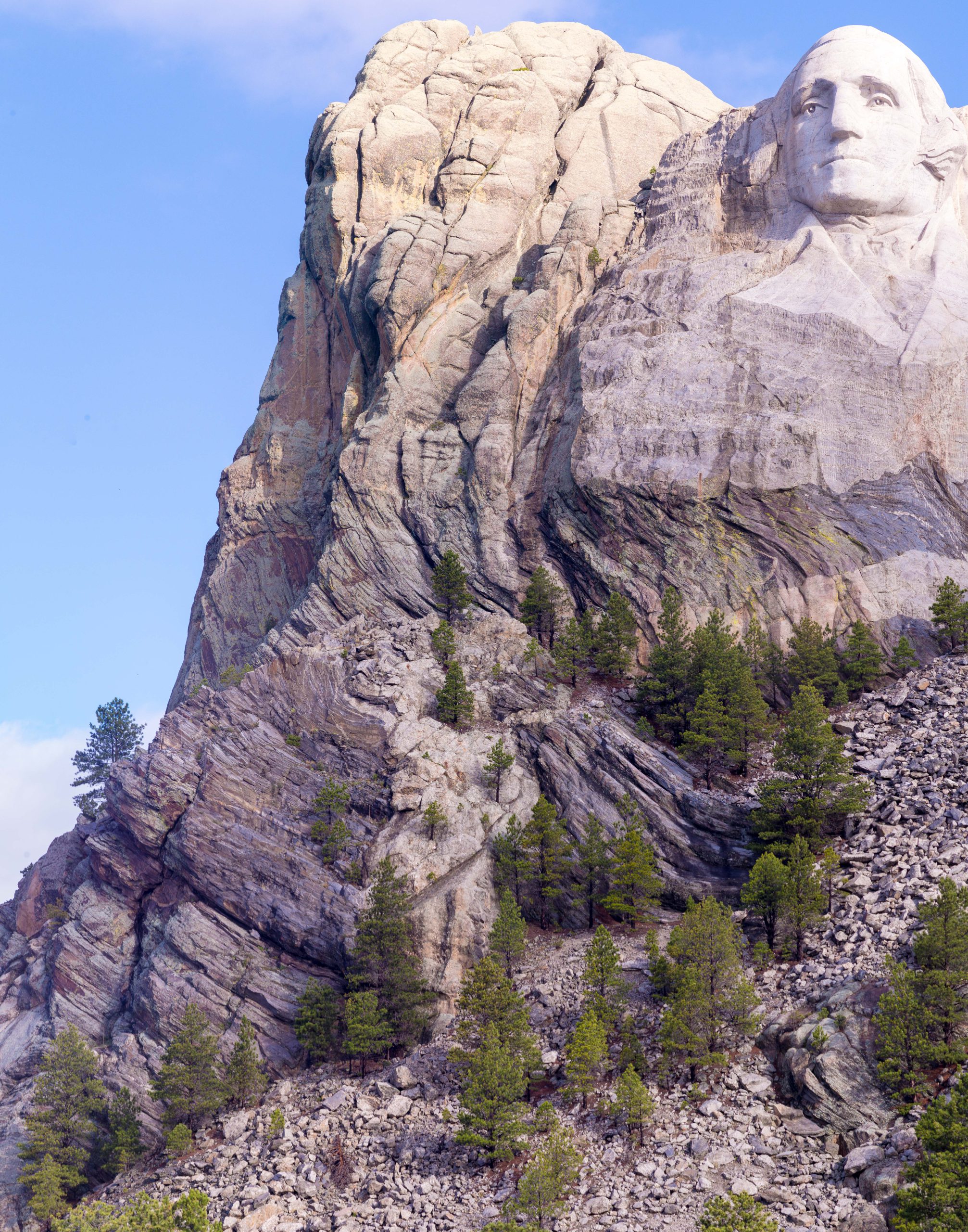
There were a couple of things that caught my attention. First, was how the figures meld into the landscape. The curves of the stratum embrace the figure of Washington; the human face seems to complement the rock face. The second was the level of detail in the carving. The extension that is the pupil of…
-
Ottawa
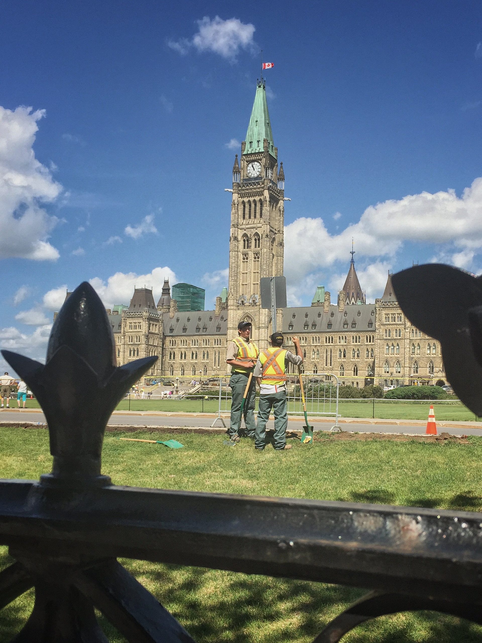
Today we visited the House of Commons, guests of Ron Liepert MP for Calgary Signal Hill. We had lunch in the Parliamentary Restaurant, followed by a quick tour of the Centre Block. We wrapped up our tour by attending Question Period. The last time I visited the House one could simply walk in. Now…
-
Saint-Jean-Port-Joli
This and the next two days will be driving days. Our goal is to get to Sydney Nova Scotia by June 2 to catch the ferry to Port Aux Basques, Newfoundland. It is about 1600 km from Ottawa to Sydney. Today we drove just over 500 km to reach Saint-Jean-Port-Joli. A cute little town located…
-
Moncton to Sydney
Even though we are in another time zone–one hour earlier–I woke at the usual time. There were 2 Celsius Degrees lingering in the air when I took a walk through downtown Moncton this morning. Past are the days of the 30C+ temperatures we experienced just a short while ago in Ottawa. The change was…
-
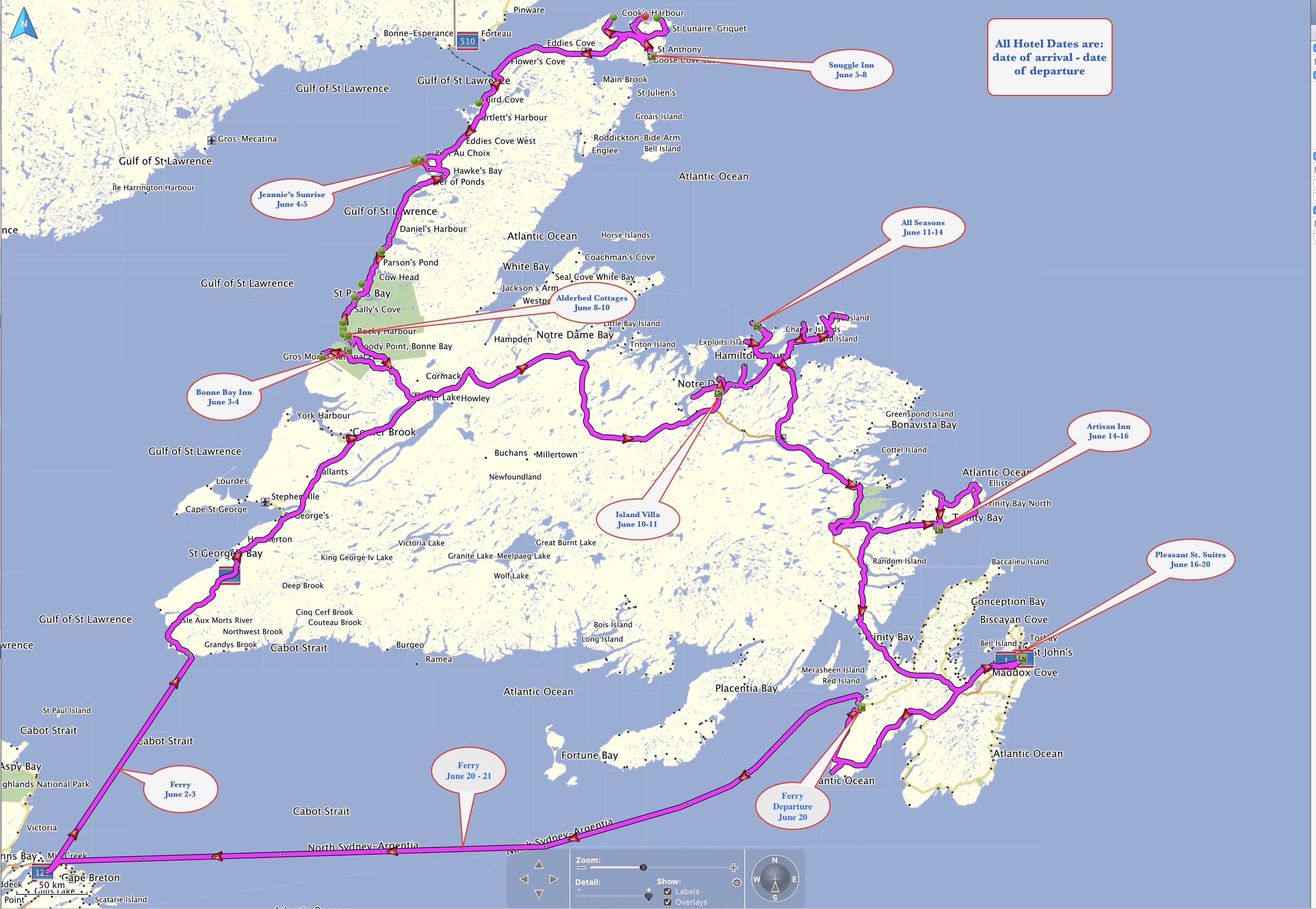
Woody Point
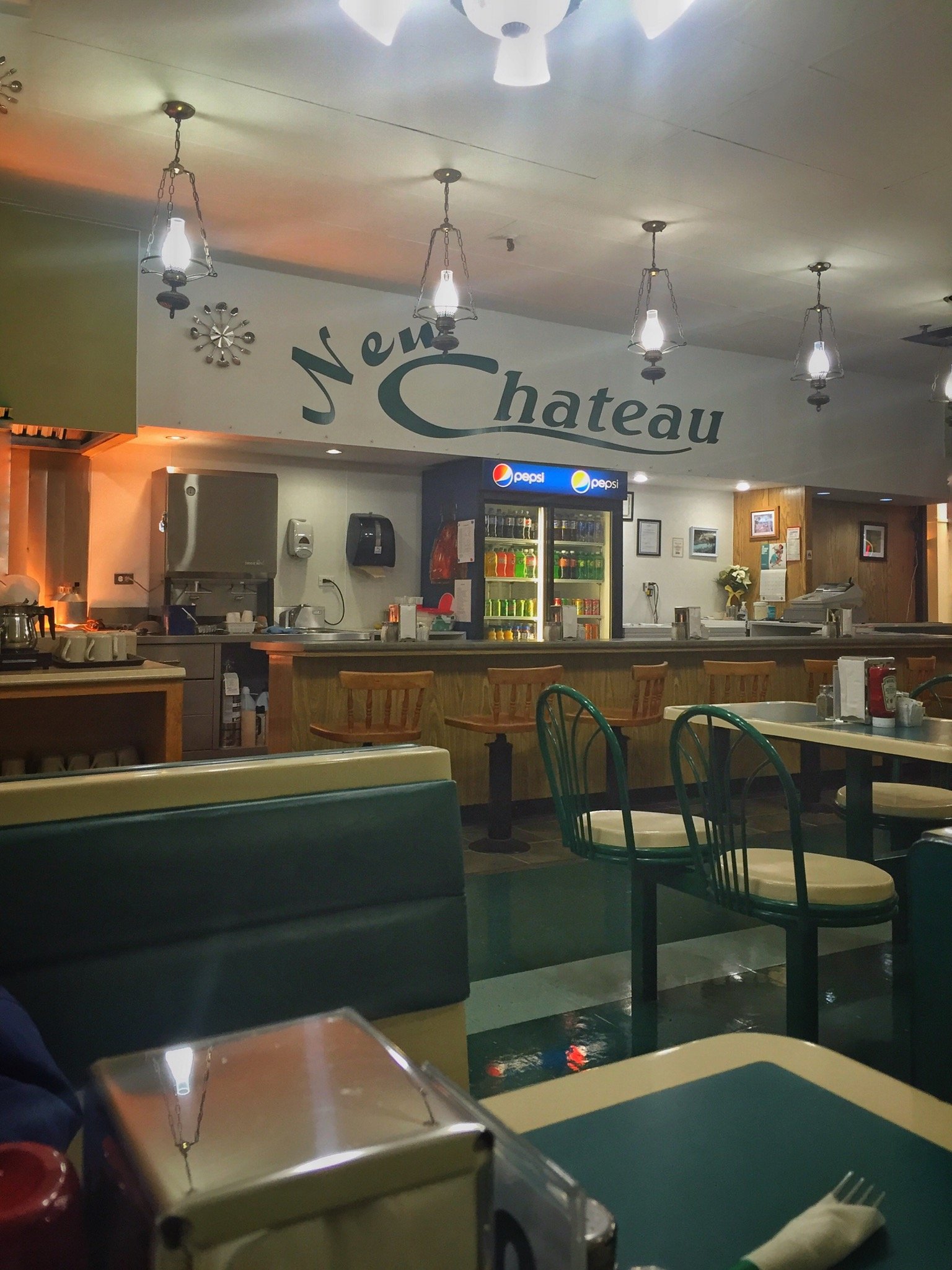
We made our way up Highway 1, the TCH (Trans Canada Highway), from Port aux Basques through Stephanville and Corner Brook to Woody Point. In Stephanville we stopped at the New Chateau Restaurant for a mid-morning breakfast: two eggs over well; bacon; toast; beans; potatoes and coffee for $7.95. In Corner Brook we stopped for gas,…
-
Port au Choix
From Woody Point we drove north through Gros Morne Park to Port au Choix, and spent the night Jeannie’s Sunrise Bed & Breakfast. The purpose of this one-night stop was to break up the drive to St. Anthony which is located at the top of the Northern Peninsula. There we will visit the Viking Ruins…
-
L’Anse aux Meadows
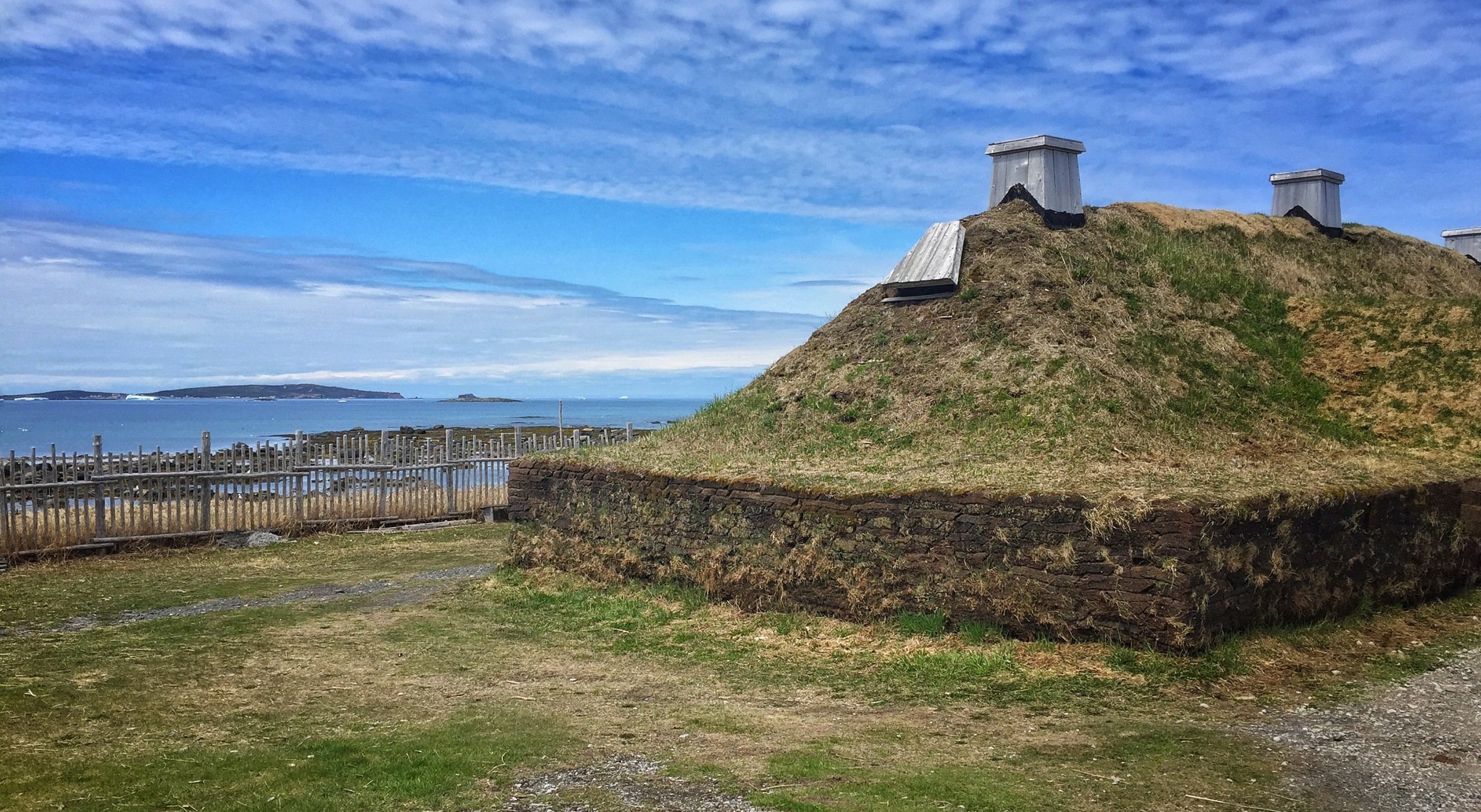
We left Port au Choix at 9:00 AM yesterday and arrived at L’Anse aux Meadows before noon to visit the Viking settlement. Following that we checked into the Inn in St. Anthony. Other highlights of the day included: seeing three moose as we drove north; drinking iceberg beer (water from icebergs); eating cod tongues with…
-
St. Anthony
Yesterday started with a boat ride out into the sea to look for icebergs. Later we hiked around Fishing Point. Following that we drove north to Saint Lunaire-Griquet to buy some seafood at Hedderson’s Fish Market. While it was clear, but cool, in the harbour at 9:00 AM for the boat ride, once we got…
-
St. Lunaire-Griquet
Our second full day in St. Anthony was marked with fog and drizzle. Along the shore, cold winds blew off the sea. As a result our outdoor activity was conducted within the protective shield of our car. We drove around the area, first to Raleigh, then to Ship Cove and Cape Onion co-located at the…
-
Rocky Harbour
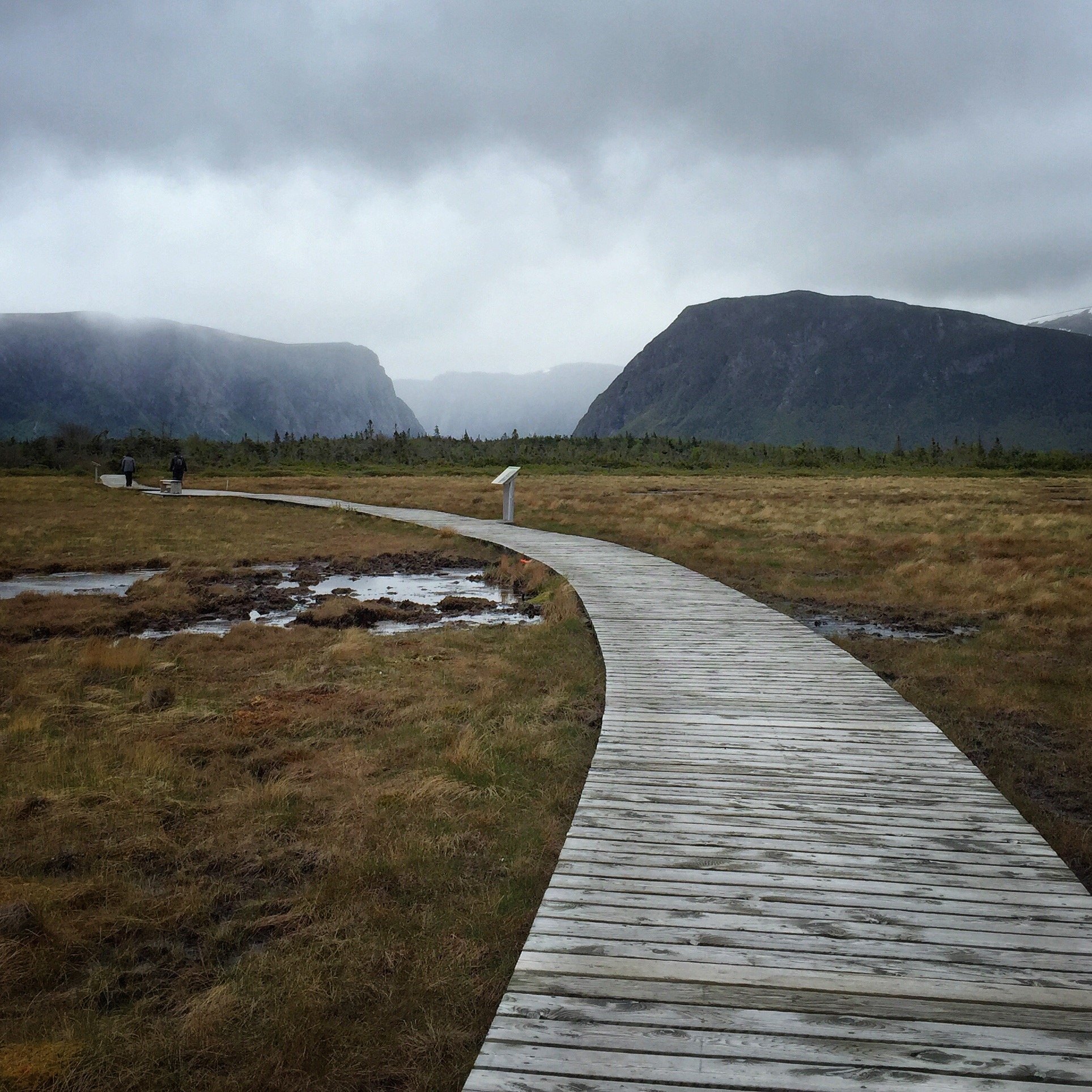
We arrived in Rocky Harbour Wednesday afternoon. The main goal was to see Western Brook Pond. Formerly a fjord, it lost that designation when it was cut off from the sea. However, for the layperson, few of the physical characteristics would suggest it is no longer a fjord. Western Brook Pond is about a 30…
-
Lewisporte
Yesterday was a travel day; a drive from Rocky Harbour to Lewisporte. As we approached our destination the weather changed to fog and drizzle. With that we decided to relax and have a quiet day. For dinner we visited Chelsea’s Fish & Chips, located just outside of town. Chelsea’s is not a classic restaurant:…
-
Change Island
We took the 10:30 ferry to Change Island, located north east of Twillingate. The crossing was just under 30 minutes. The cost was $12 return for the three of us and the car. The return ferry, scheduled for 5:00 didn’t arrive until 5:40. The weather turned out to be excellent; clear skys and a warm 13C. …
-
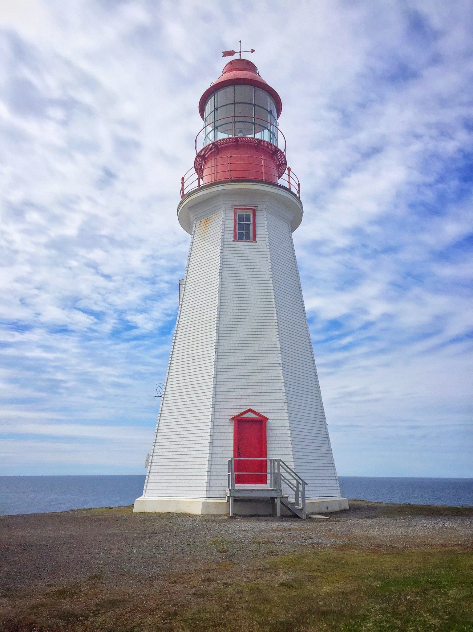
Twillingate
We stayed 3 days in Twillingate. On the first we took a few hikes, one by the Lighthouse on Crow Head and a second on Burnt Island Tickle. Our second day was spent on Change Island, which I covered in an earlier post. The last day was one to relax; it was raining so we…
-
Trinity
Trinity is a beautiful, maybe idealised, little village. It appears to be largely oriented towards tourism. Most of the people walking on the streets, in the stores and restaurants look like tourists. Many buildings look geared to tourism. Many are classified as historical buildings and are accompanied by a plaque outlining it’s story. We…
-
The Bonavista Peninsula
Giovanni Caboto (or Zuan Chabotto in Venetian) landed in Cape Bonavista in 1497. We got there in 2016. Well, in fact the landing site was in dispute until “…for the 500th-anniversary celebrations, the governments of Canada and the United Kingdom designated Cape Bonavista in Newfoundland as the “official” landing place.” Coming to a conclusion of course…
-
Trinity and Fort Point
Looking out from our cottage in Trinity, across the harbour, was a lighthouse. It occupies the spot that was formerly Fort Point. The Fort was built in 1746, taken by the French in 1762 and destroyed, recovered and rebuilt in 1780 and again in 1812 and then left to decay [1]. Now there are few…
-
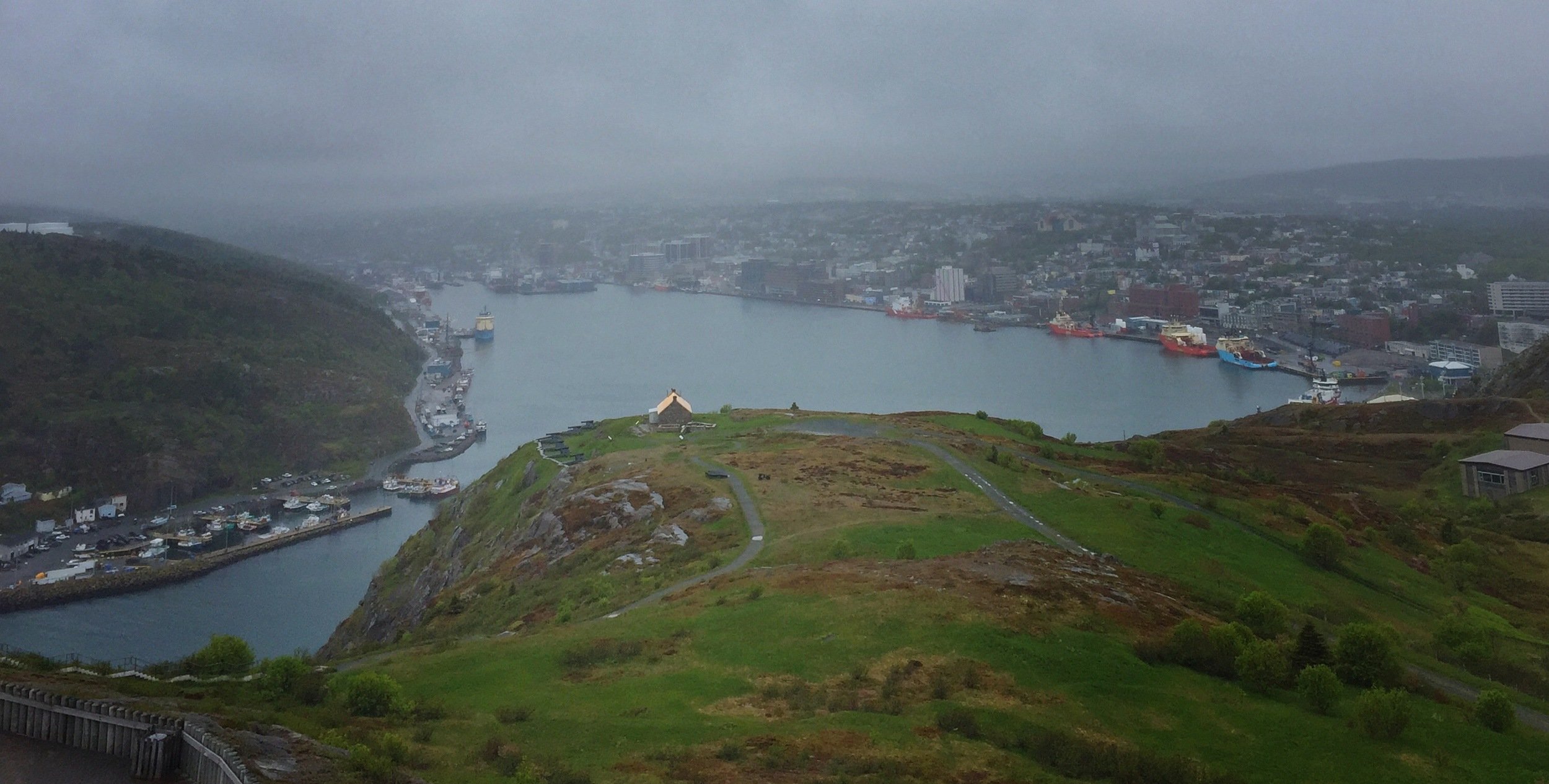
St. John’s
Yesterday was our first full day in St. John’s. We toured around some of the major attractions (Signal Hill and Quidi Vidi Brewery), met a friend for dinner and listened to Newfoundland Folk Music. In St. John’s we’ve rented a duplex, the main floor and basement portions. It is located within a 10 minute walk…
-
Cape Spear
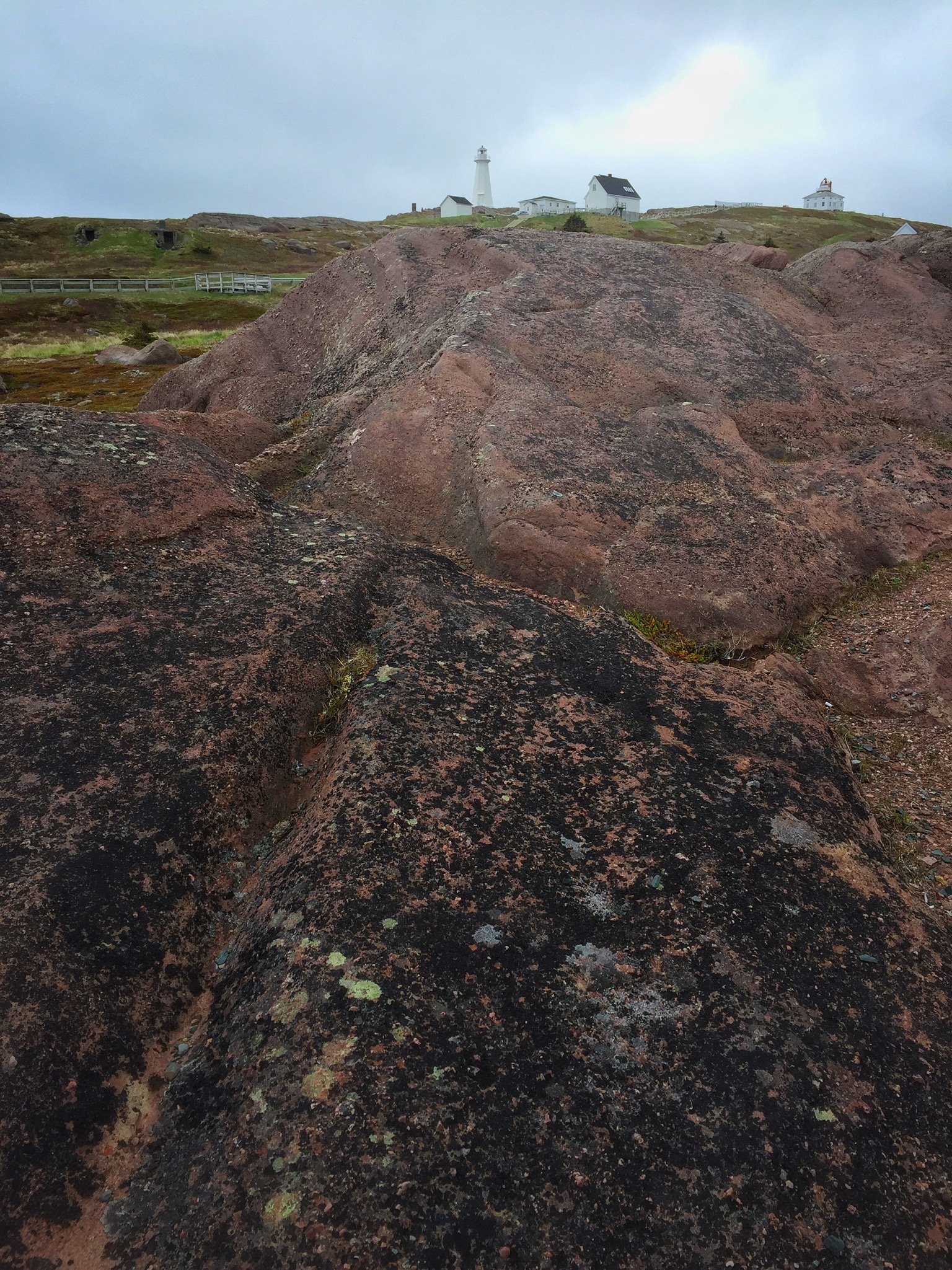
Yesterday, we drove to Cape Spear then continued west through Petty Harbour and Bay Bulls and finally returning to St. John’s and a walk downtown. Cape Spear currently hosts a lighthouse, but formerly hosted a fortress guarding the entrance into St. John’s Harbour. The Cape is also the eastern-most point of land on the North…
-
Bay Bulls
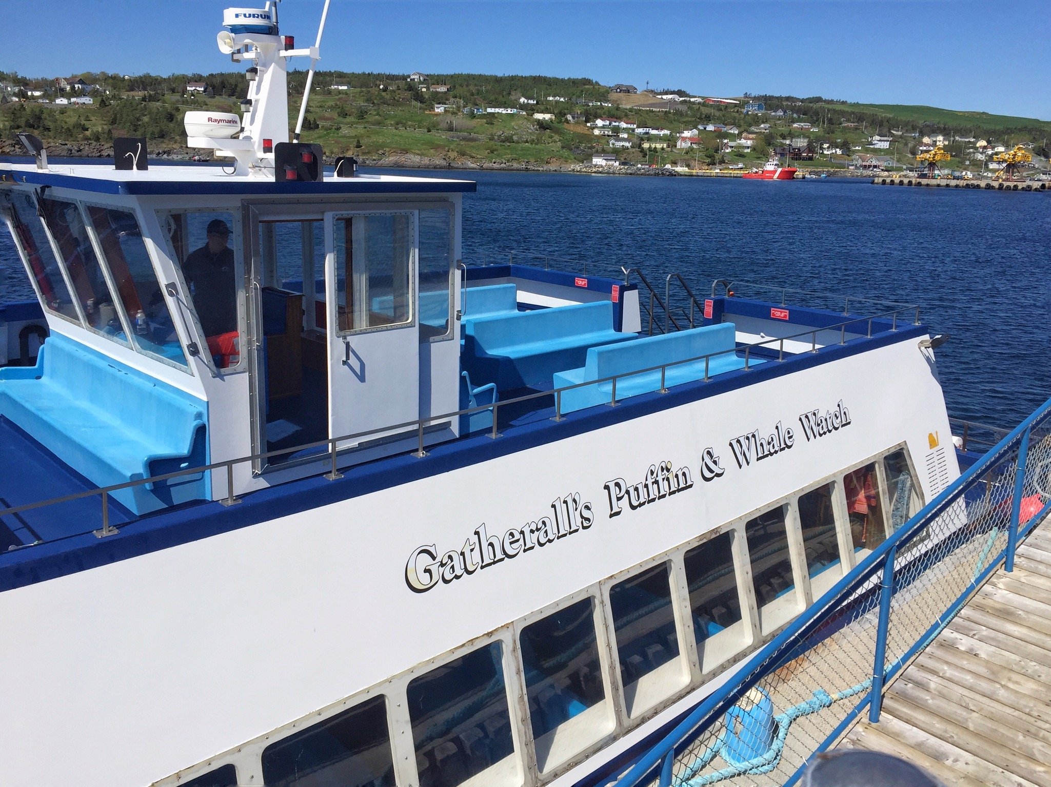
Yesterday’s main event was a boat cruise out to Gull Island, off Bay Bulls, just west of St. John’s. Prior to the cruise we returned to Cape Spear as it was along the way. We ended the day with a walk in the area we are staying in St. John’s. It was a sunny and…
-
Argentia
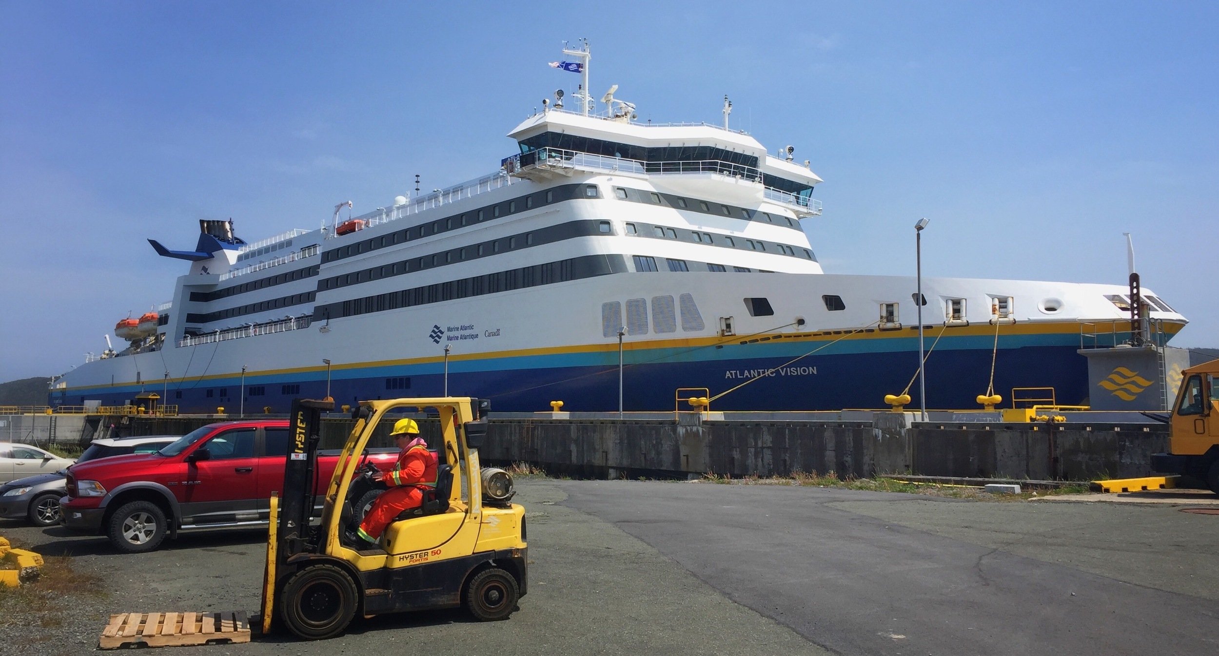
Our last stop in Newfoundland was the terminal at Argentia for the ferry to Syndey Nova Scotia. Unfortunately the departure was delayed nearly 11 hours. This delay will impact our visit to Louisbourg and the Cabot Trail. We had dinner on board while we waited for departure; it turned out to be excellent. We all had…
-
Louisbourg and the Cabot Trail
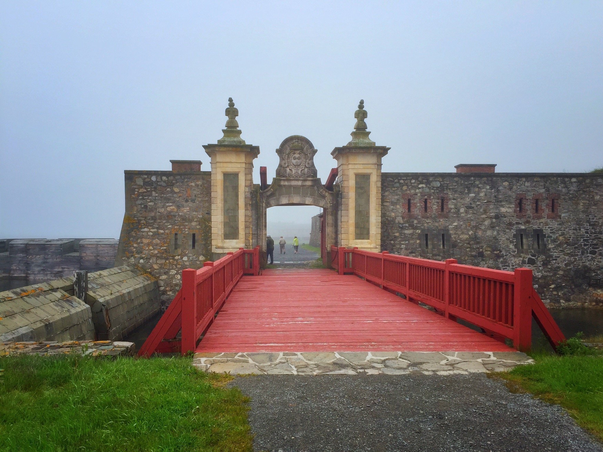
As a result of the delayed ferry we had compress our visit to Louisbourg and our drive along the Cabot Trail. As it turned out, weather complemented these decisions. We left the Inn where we were staying in Lousibourg and arrived just before the gates opened. At this time of year visitors are bussed to…
-
Charlottetown
We left Chéticamp Nova Scotia fairly early and drove about 6 hours to Charlottetown PEI. We decided to cross over to PEI on the Confederation Bridge. While there is a ferry service to the island, that was closer, co-ordinating with the schedule proved more cumbersome than necessary so we drove the extra distance. The toll for…
-
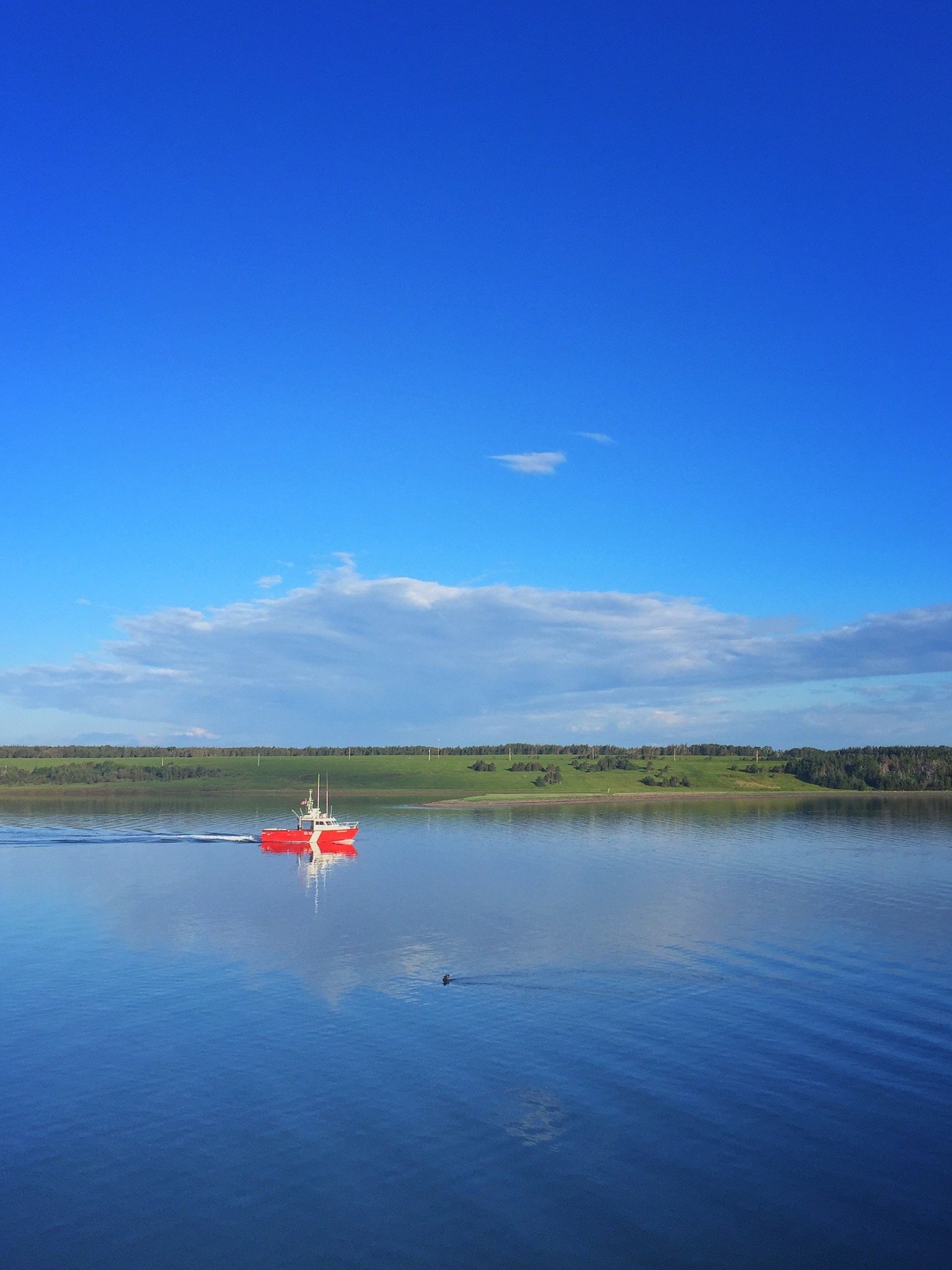
Northshore
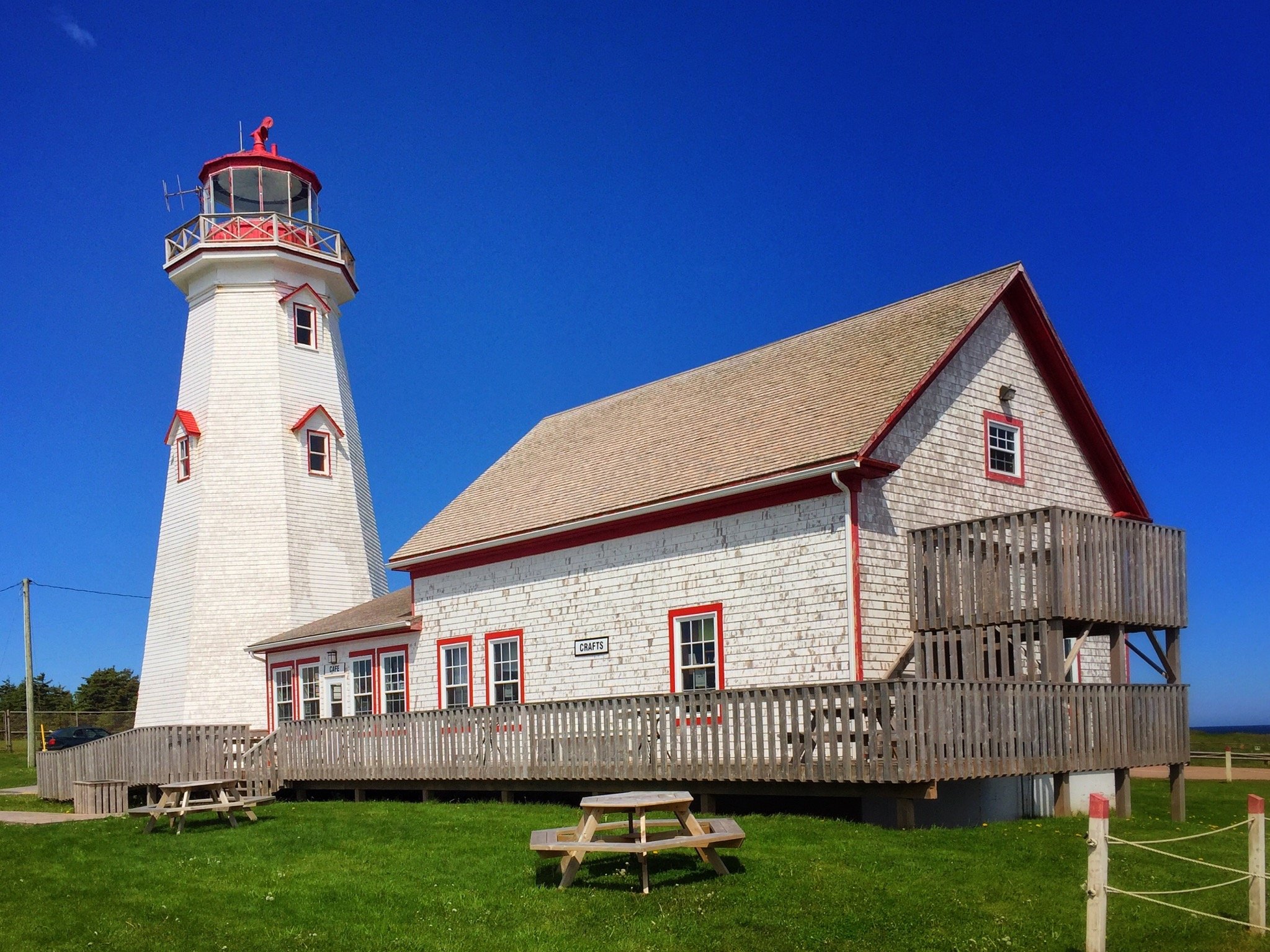
Yesterday we drove from Charlottetown to East Point, and then along the North Shore of the Island to Greenwich and the back to Charlottetown. We climbed to the top of the lighthouse at East Point which gave us a view of the Point and beaches. On the North Shore we stopped into the fishing…
-
Miscouche
Yesterday was a gentle day, we drove north from Charlottetown to Prince Edward Island National Park, and then along the Gulf Shore Parkway to Green Gables and then south to Miscouche to spend the night. Our goal for the coastal drive was to find the red sandstone cliffs facing the sea we recalled from our…
-
Malpeque
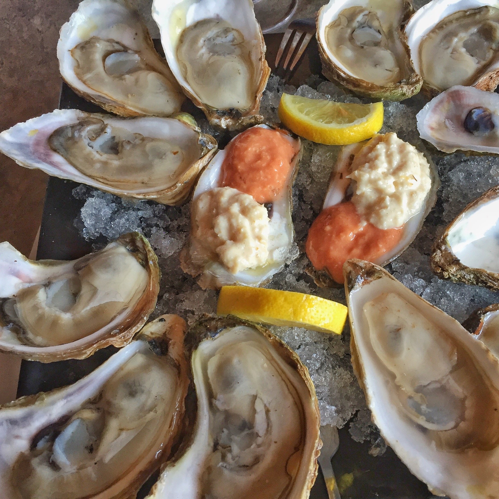
Yesterday had one objective. Have oysters in Malpeque. The village is famous for these little molluscs. They come in two sizes: small and large and are served in two portions: a half dozen and 1 dozen. I had 2 dozen. They were good.
-
The Return
I returned home last week, July 15th, after just over 8 weeks on our latest travel assignment. Since returning I’ve been able to prepare a slideshow (just over 3.5 minutes) of some shots from Newfoundland. A photo essay of our trip to Newfoundland in June 2016
-
Newfoundland Road Trip
Referring to our recently completed travels as the Newfoundland Road Trip really speaks to the main destination; it ignores the full extent of the drive, starting and ending in Calgary. But it is a convenient shorthand. I mention this only to avoid any confusion that might arise when photographs of areas other than Newfoundland are…
-
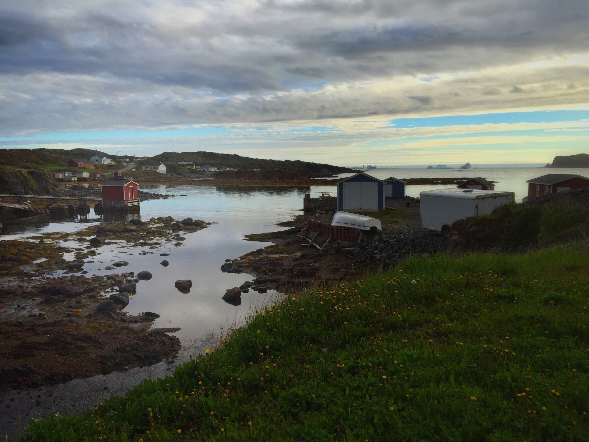
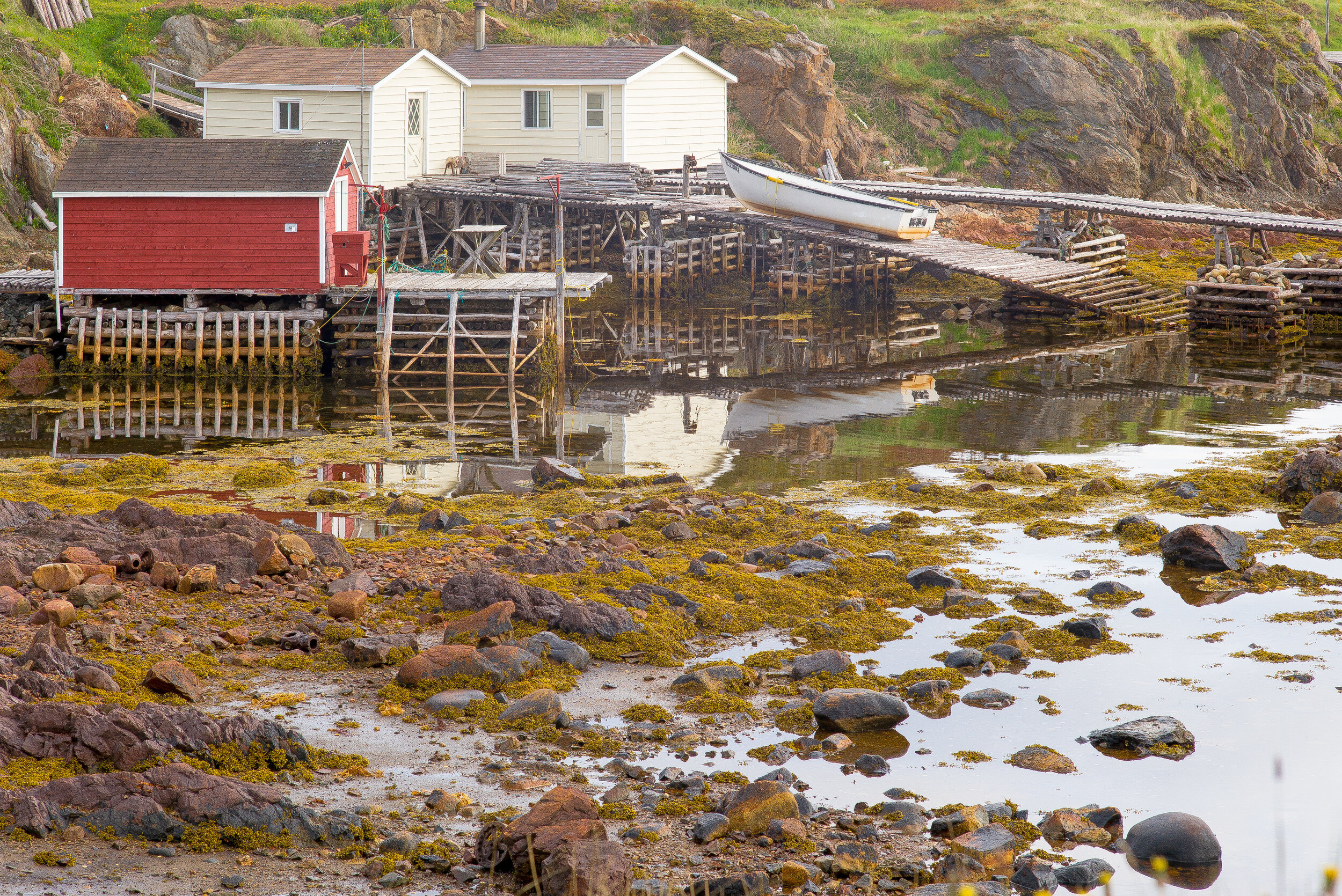
Harbour in Change Islands
I took this shot because it combined the rocks, boats and boat houses in the barren landscape that is so prevalent in Newfoundland.
-
Shacks and Ice
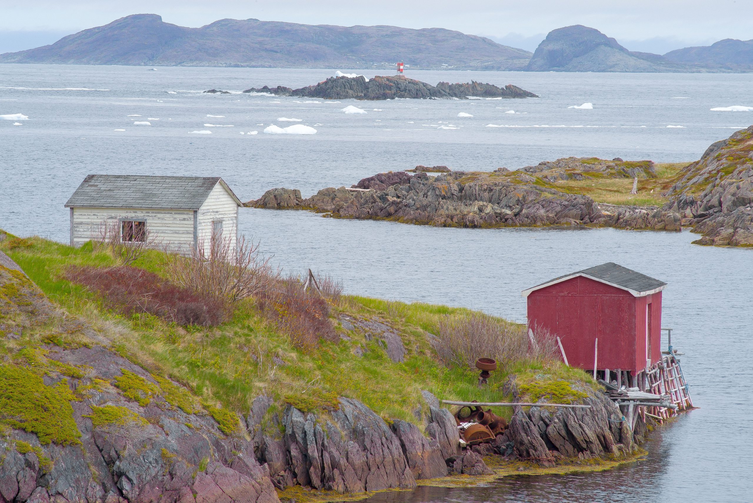
This is another shot from Change Islands. This captures boat houses in the foreground, ice (bergy bits) drifting through the channel mid-ground, and barren hills in the background. I used a 400mm lens to compress the depth of field.
-
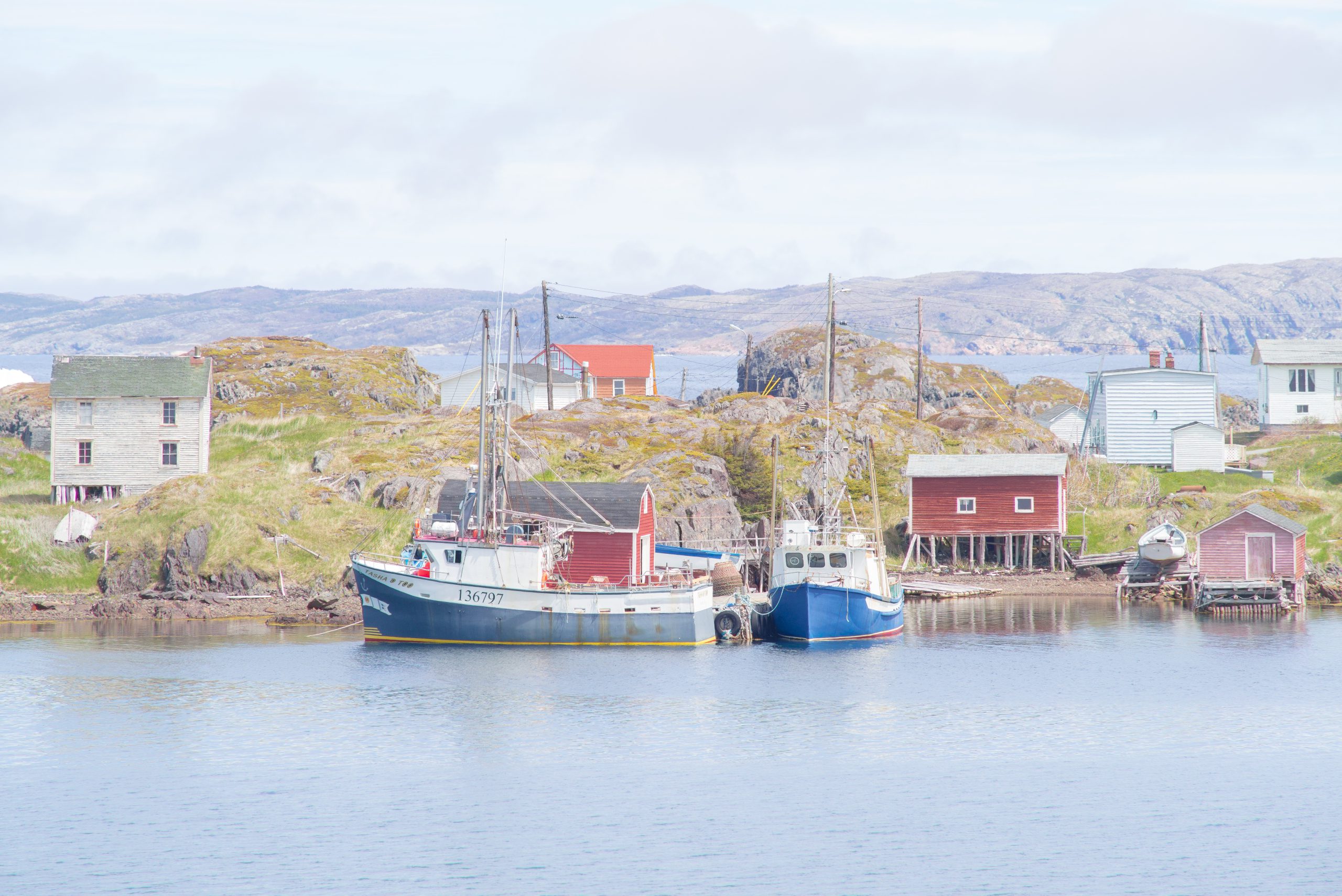
Residential Area
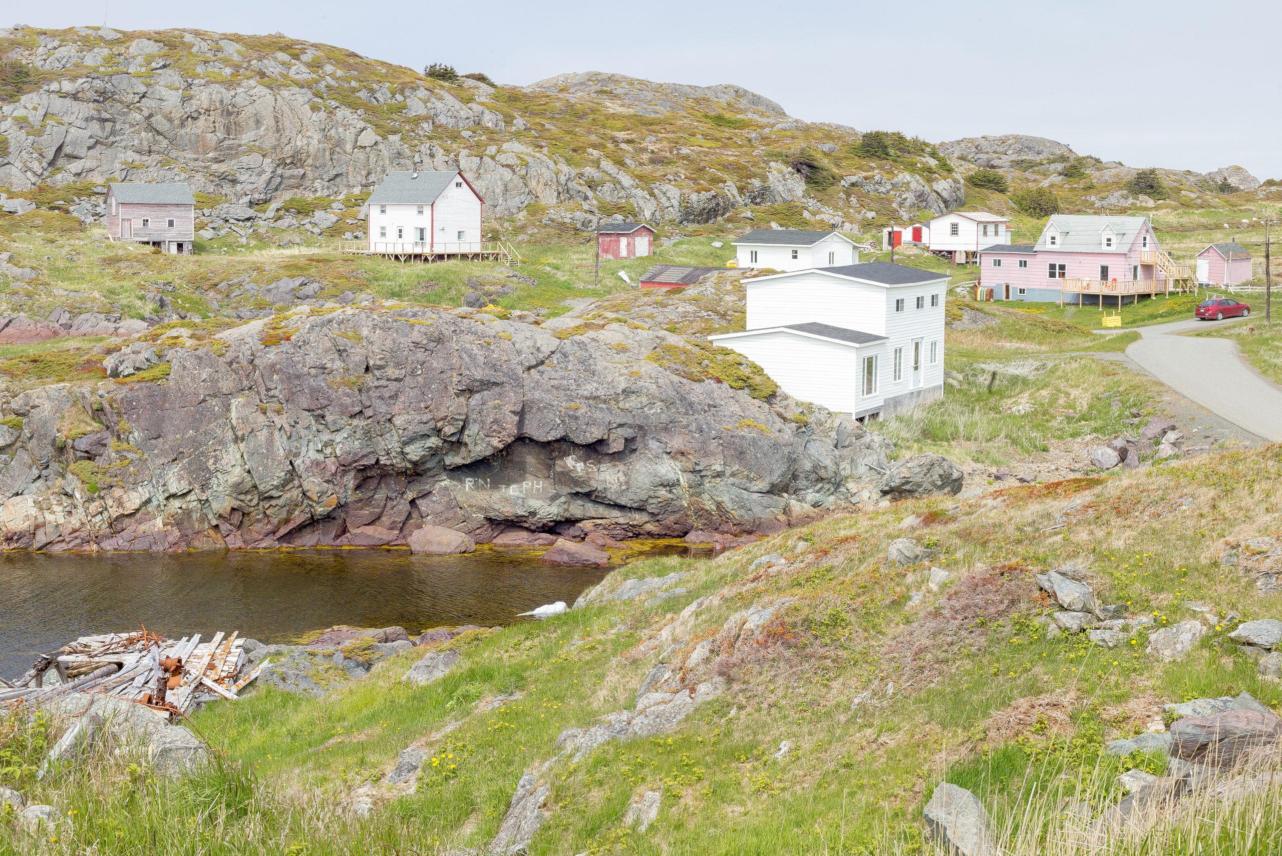
This image captured, for me, several elements of homes in the smaller villages of Newfoundland. Most are covered in clapboard and are of practical design. The structures are positioned to fit the terrain; not the other way around. This can result in what appears to be odd placements (and sometime orientations) of the structures. This…
-
Looking Out to Sea
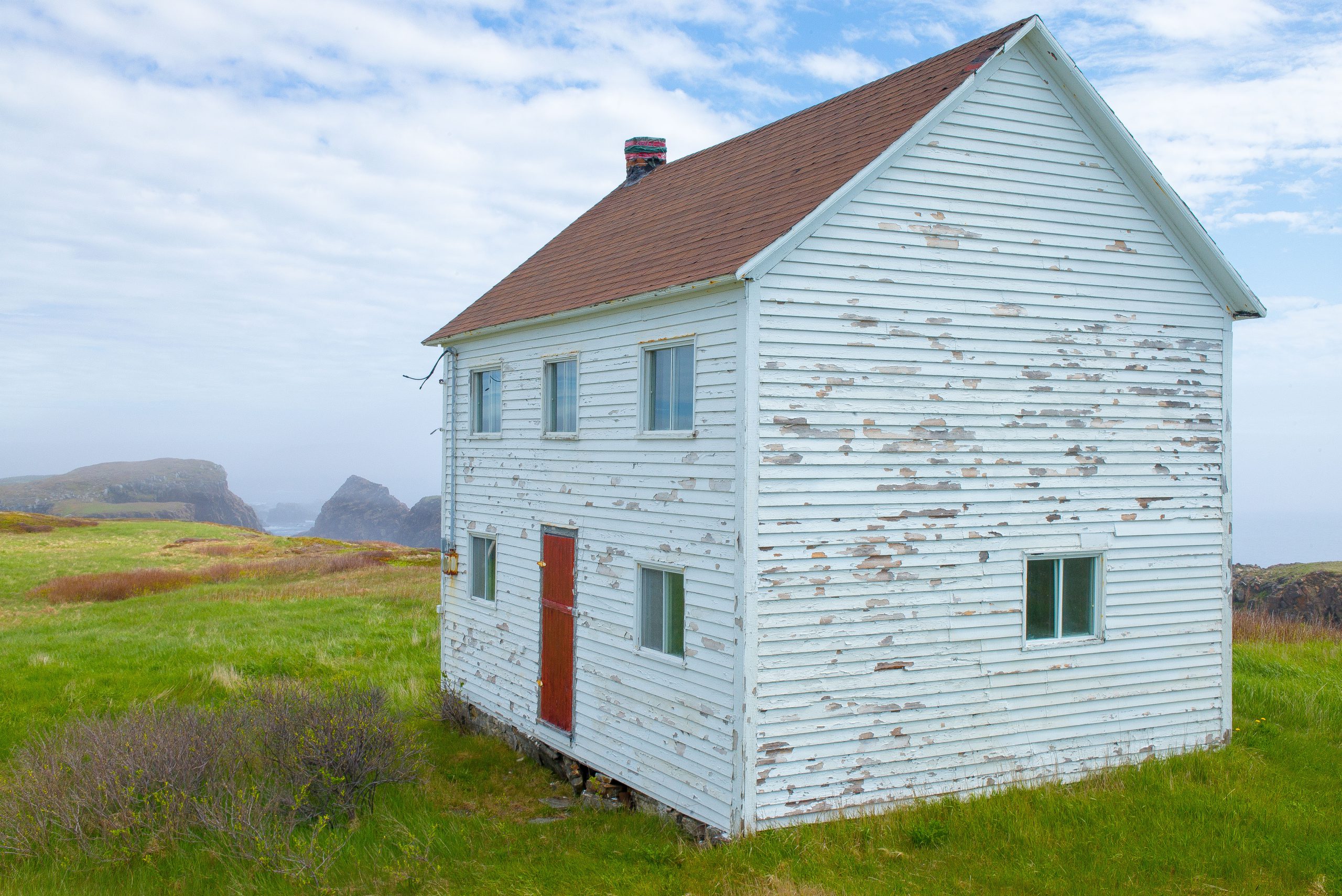
I took this shot because of the state of the house, it’s view of the rocky cliffs and the sea beyond, on this day shrouded in fog, and the colours.
-
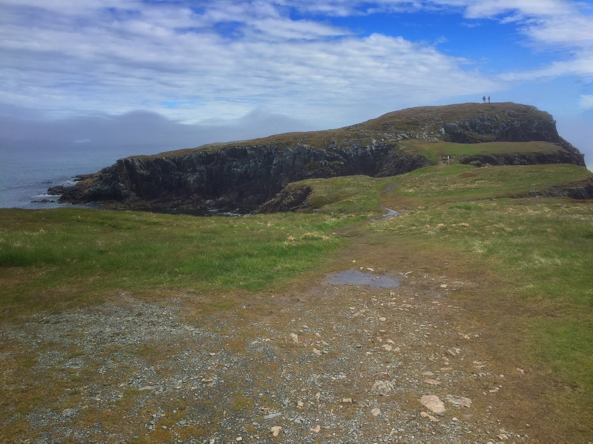
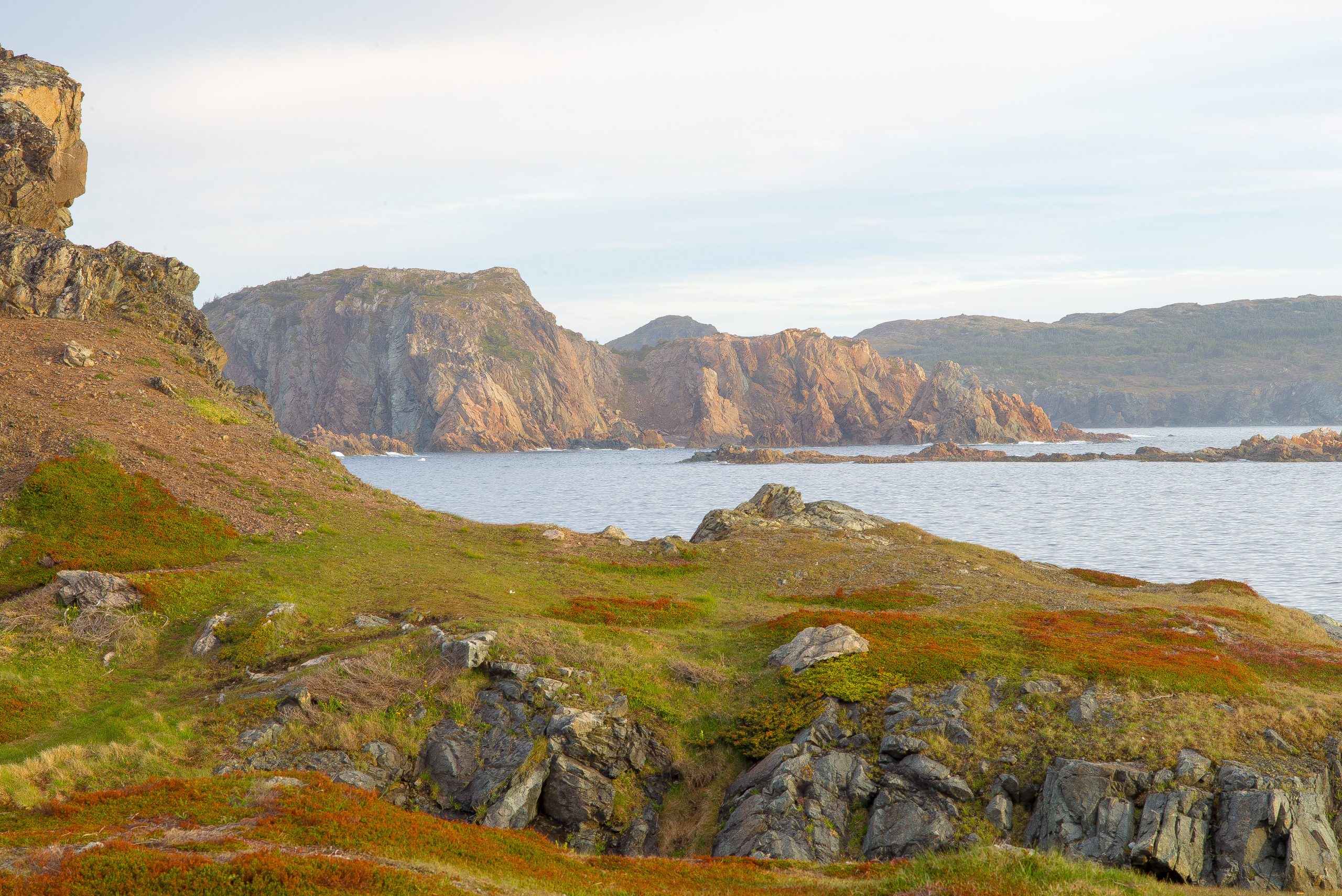
Cliffs
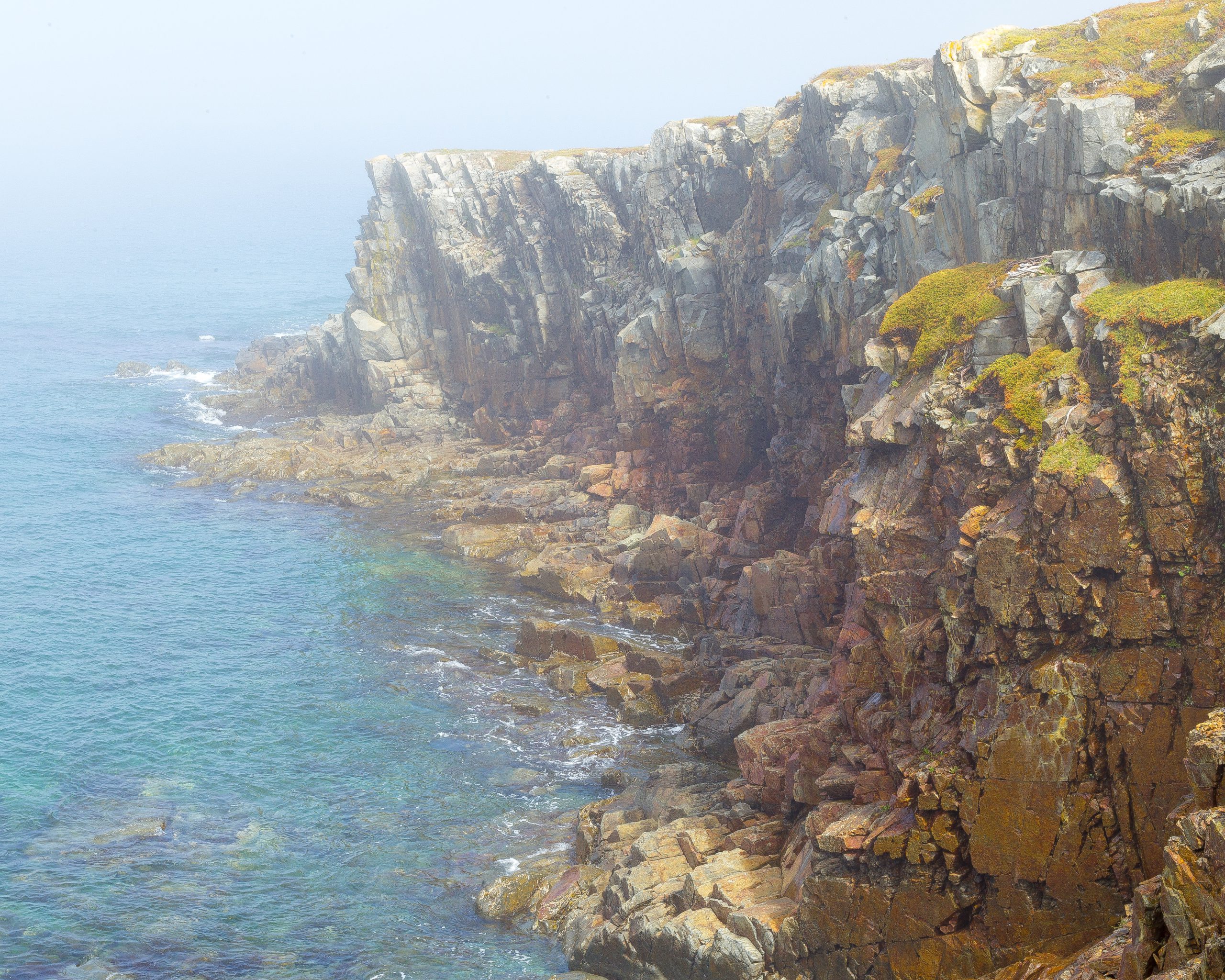
I took this shot, in part, because it mirrored a similar shot I had taken last year in Ireland. As well, the sheer ruggedness of the cliff face and the partial fog.
-
Old Yard
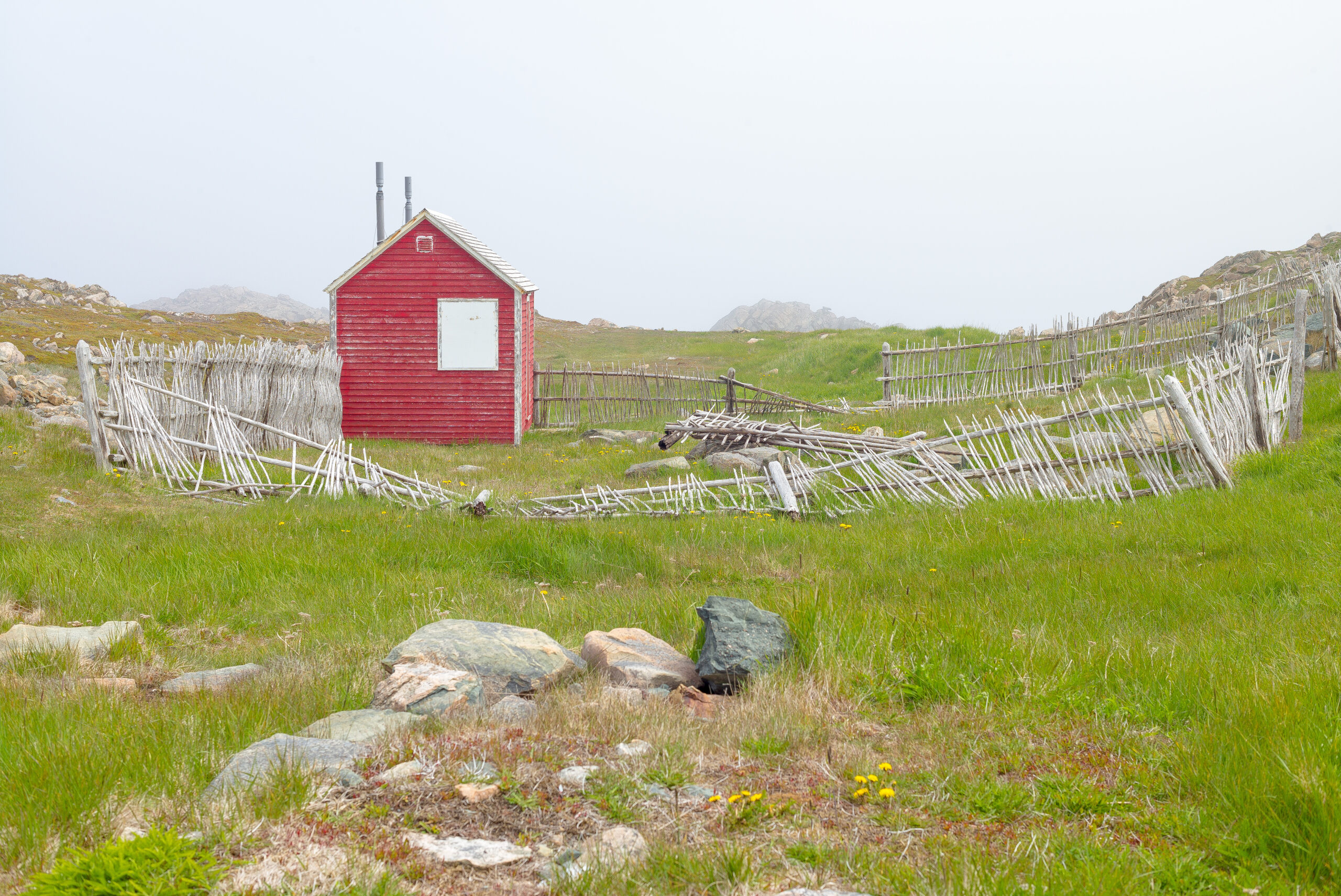
I took this shot because of the landscape, the isolation, the fog, the colour of the hut, and the shape of the broken-down fence.
-
Trinity Lighthouse
I took this shot because I liked the position of the lighthouse, perched on top of a rocky cliff, the shape of the rocks (leading lines), and the dandelions.
-
Cape Spear Lighthouse
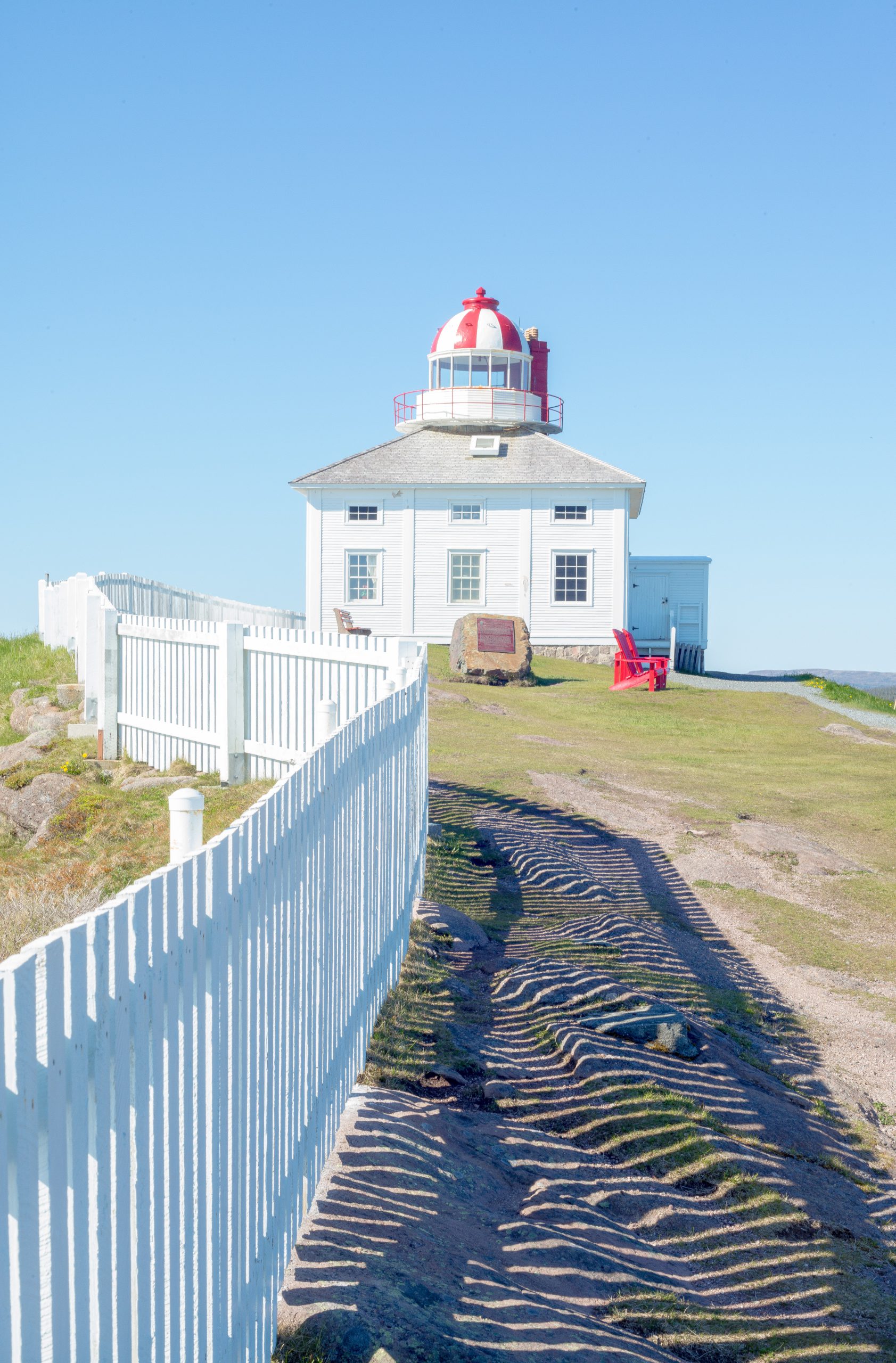
I took this shot because I liked the fence and it’s shadows that lead into the subject.
-
Sheds
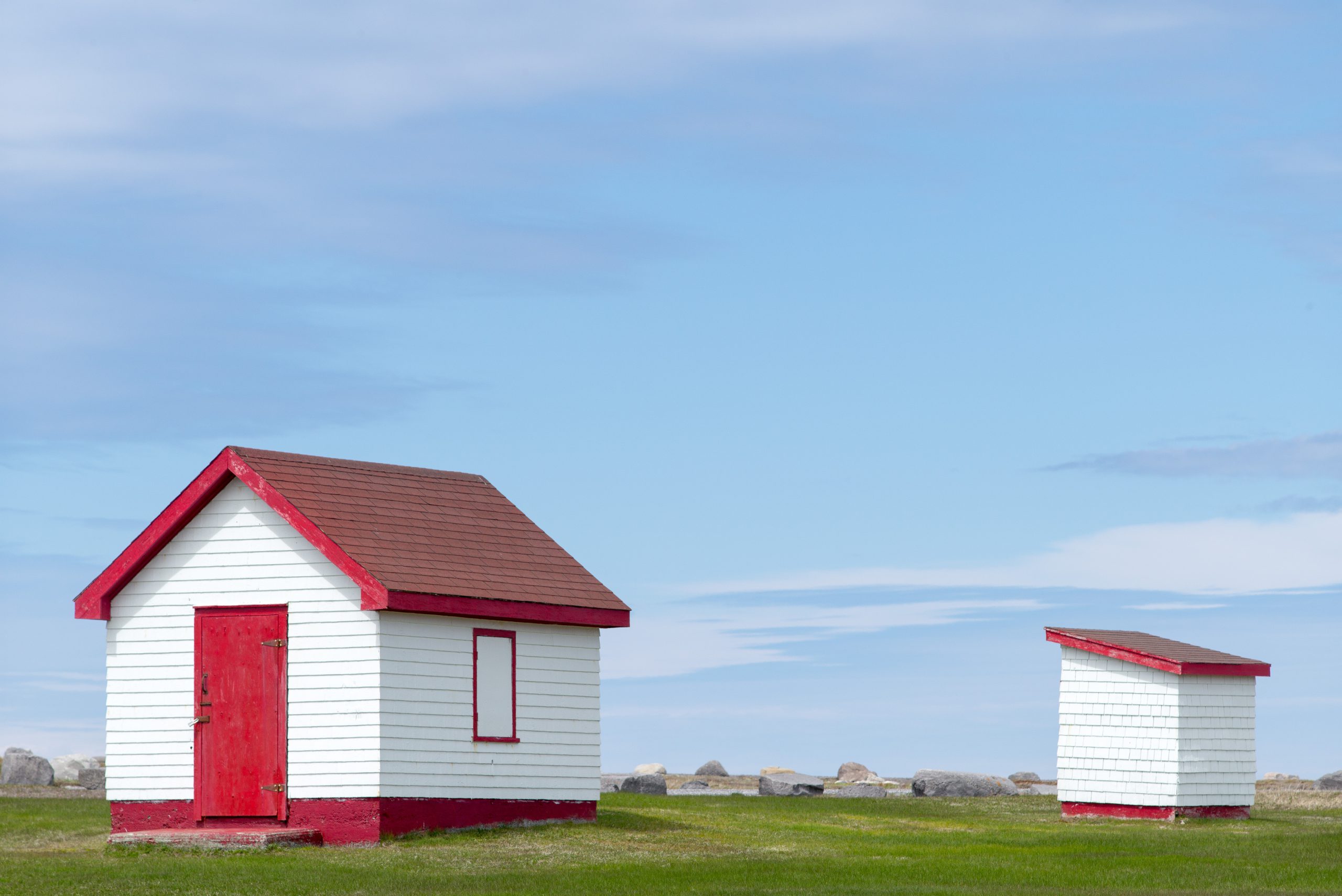
I took this shot because I liked the simplicity of the composition and the colours, notably the brightness of the red.
-
Épicerie
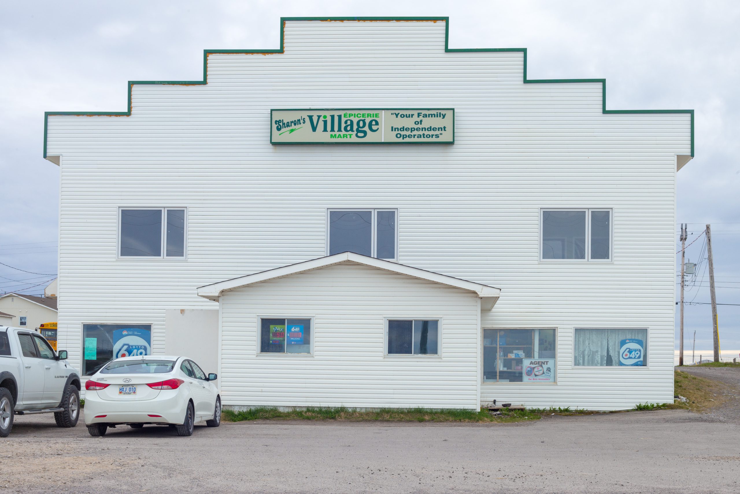
It was the white cars in front of the white building on a white day that first attracted my attention to this shot. I framed the shot to centre the building. Balance seemed to mix well with white. I wanted a portrait of the building. I liked the idea that independent grocery stores continue to operate;…
-
Farwell
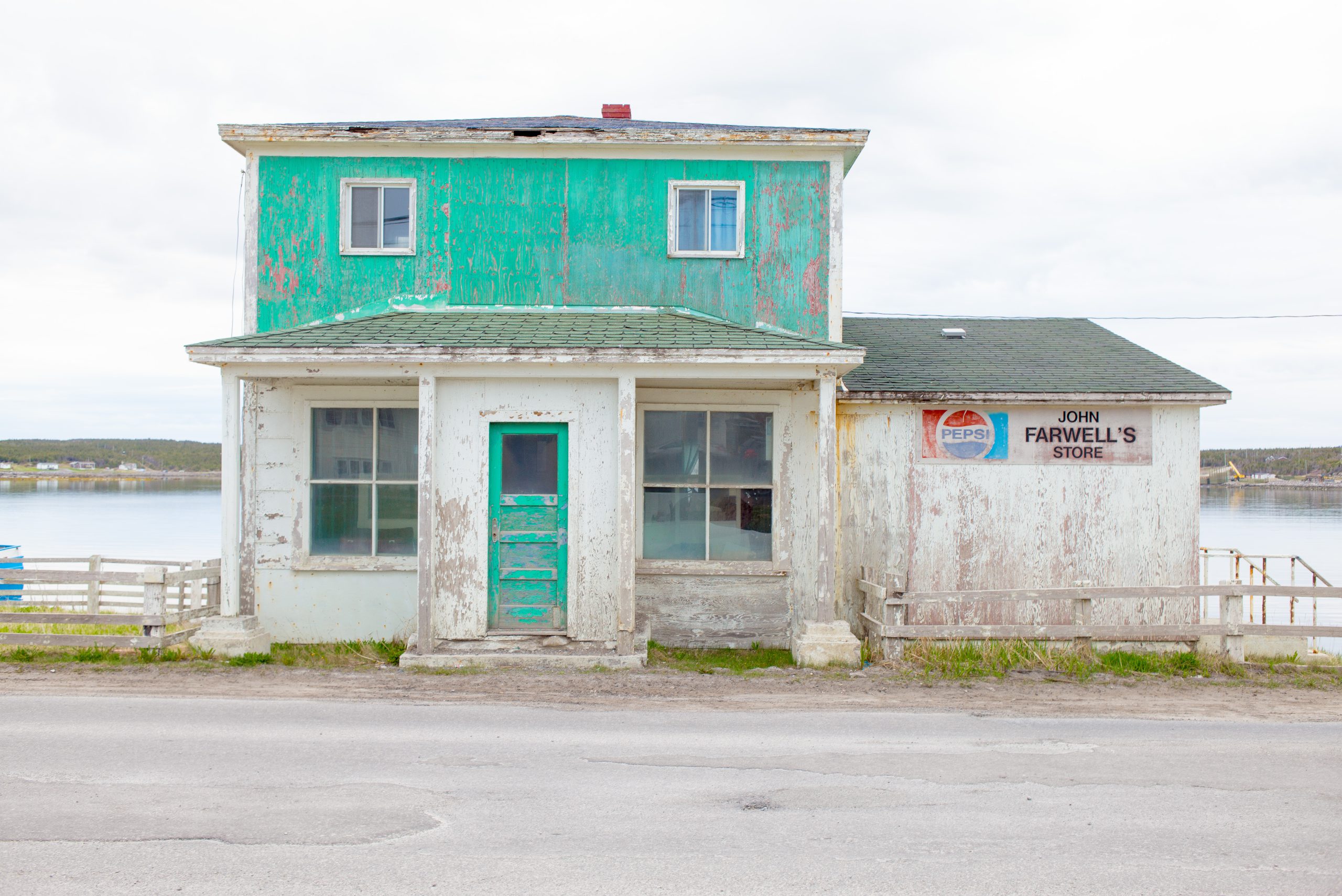
I was leafing through a photo-history book of the area and came across a photograph of this place taken many years ago. John Farwell has since passed on and his house and business are now idle. I was attracted by the colours, the Pepsi Logo, the weather-beaten facing and then the name of the proprietor…
-
Vikings
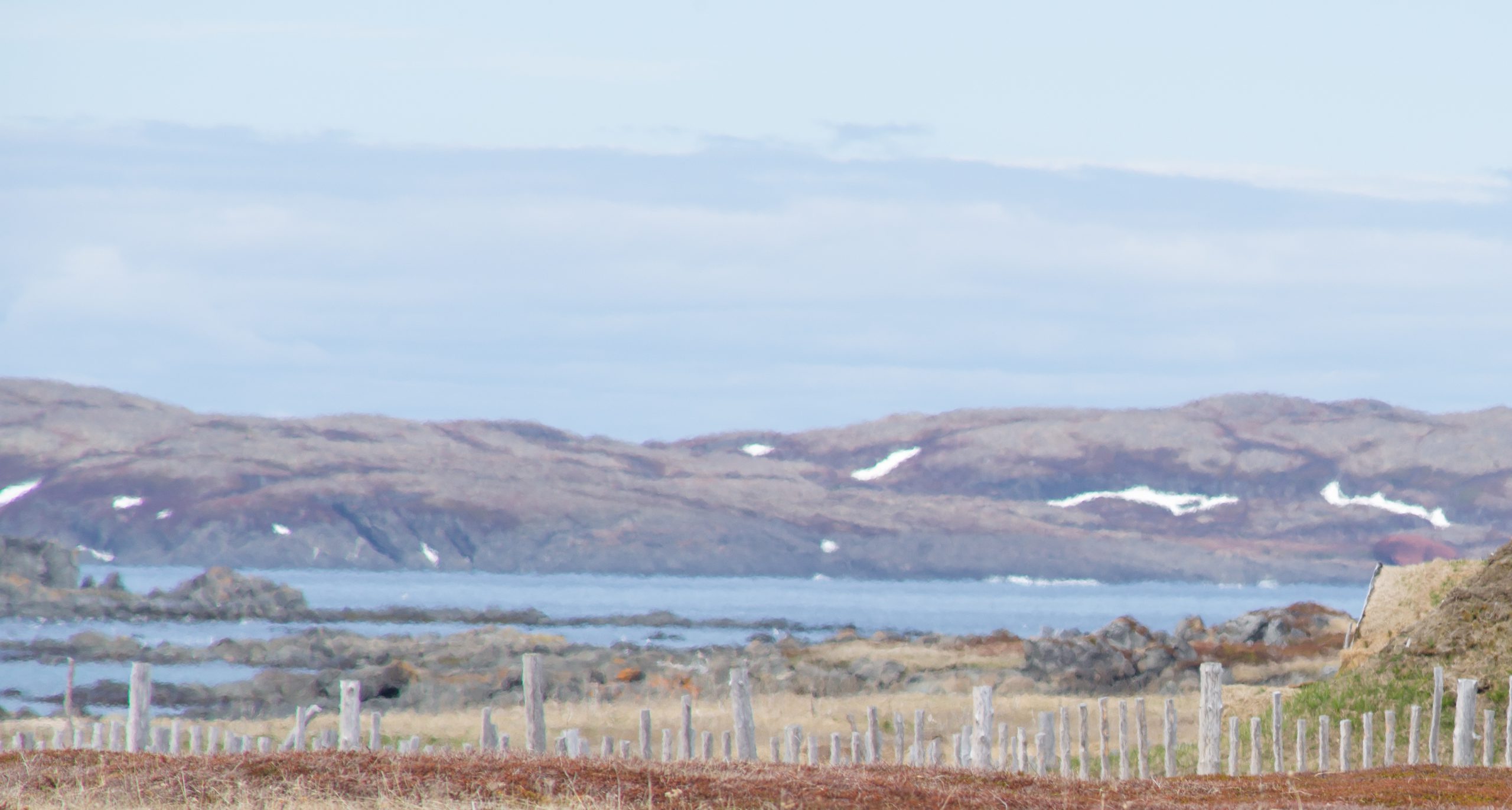
This shot is a crop that attracted my attention during post-processing. I liked the distortions introduced by the long lens and how it obscured the details and left the shapes of things; exposing more pattern and texture, especially the snow. A softer view.
-
Lighthouse
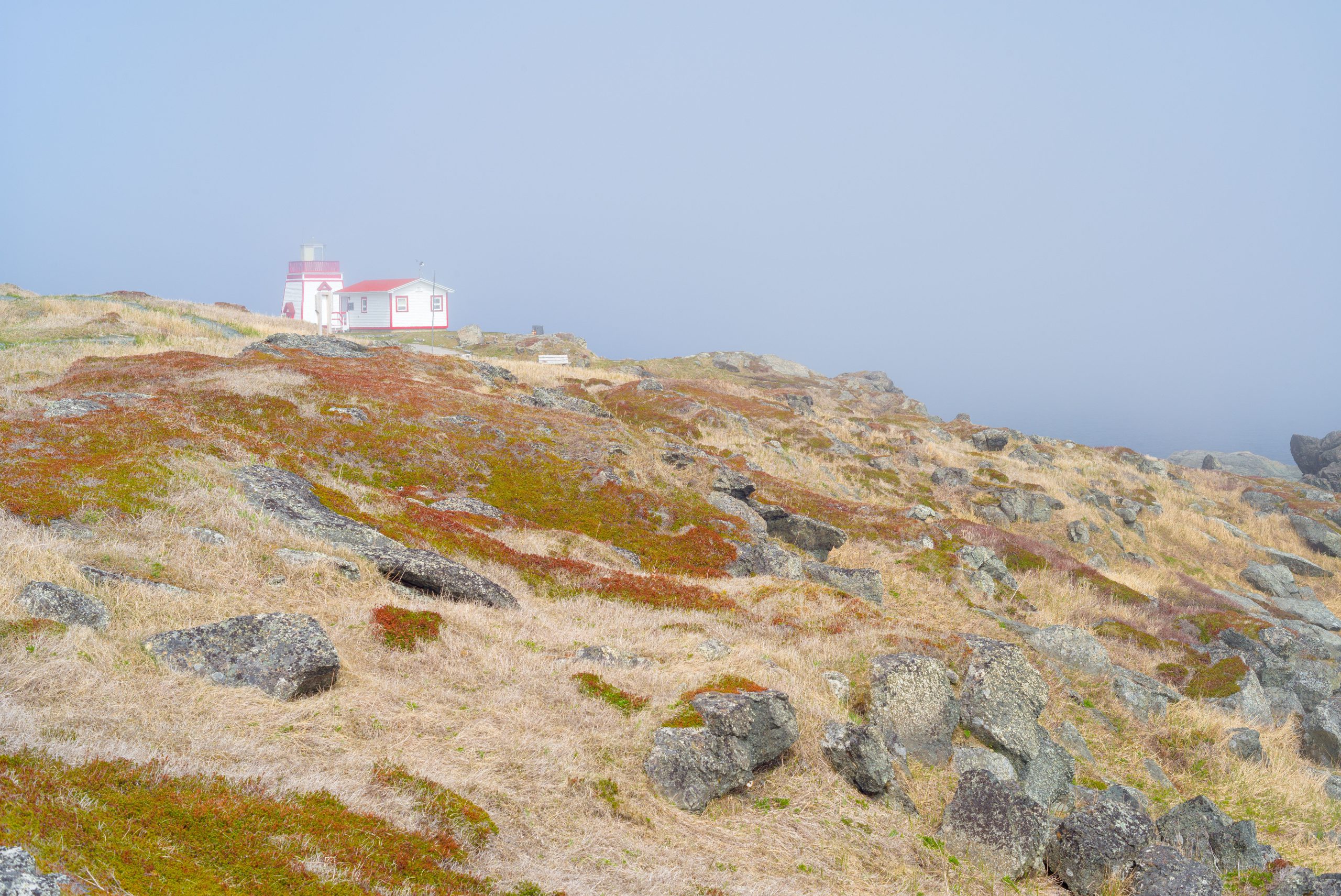
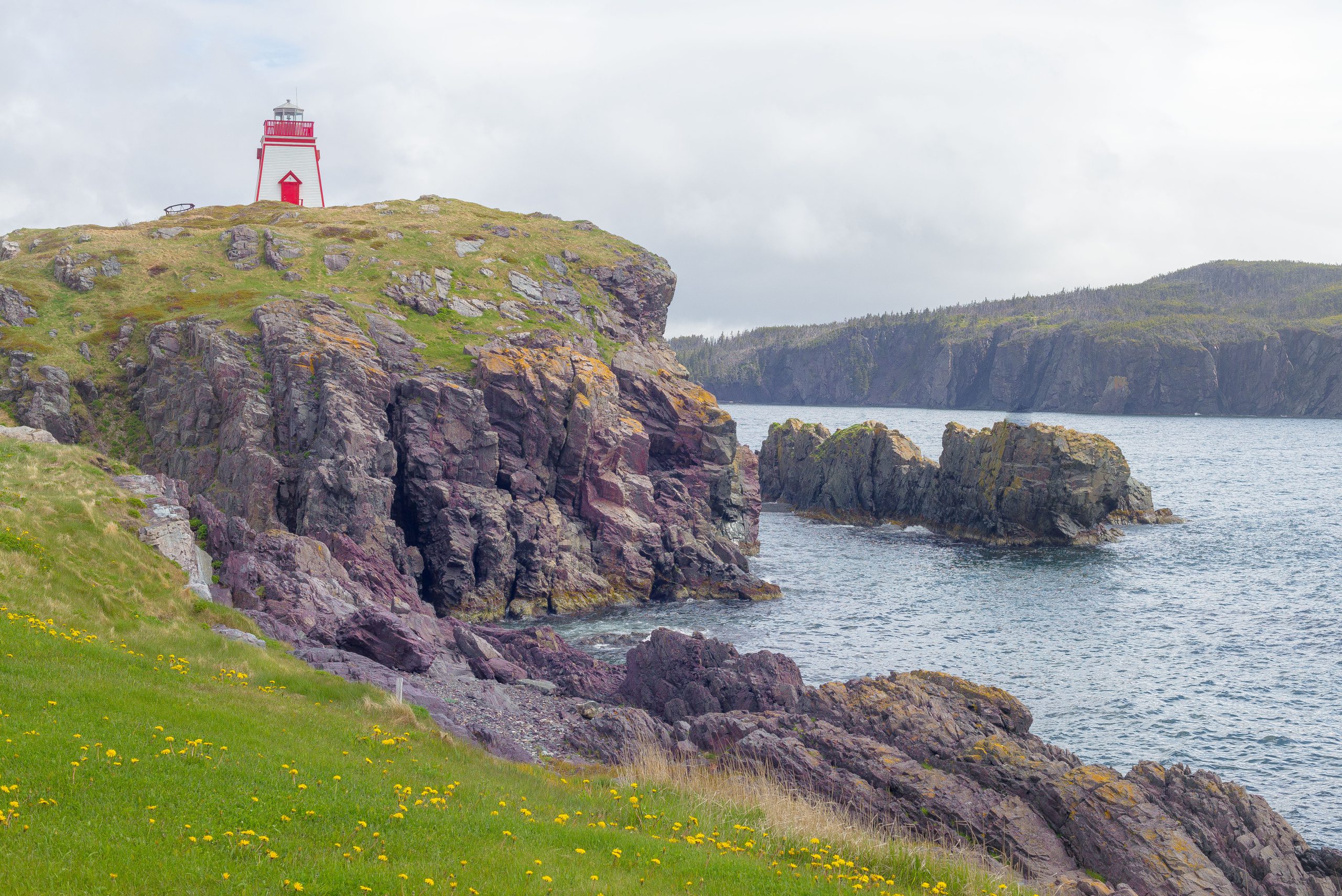
There are moments in the fog, when the softness of the air continues to blanket the scene but the sun cuts through to insert some interesting light. The contrast of the light and fog signalled the timing was right. The hard rocks and barren landscape conveyed the difficulty of living in these areas. The rocks…
-
Beacon
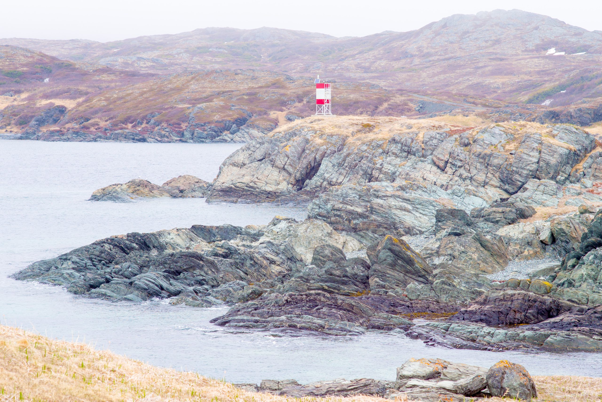
Newfoundland comes by its nickname — the rock — honestly. Another outpost of human endevour in a barren and rocky landscape. Here it was the waves and sinews of colour in the rocks that attracted my attention.
-
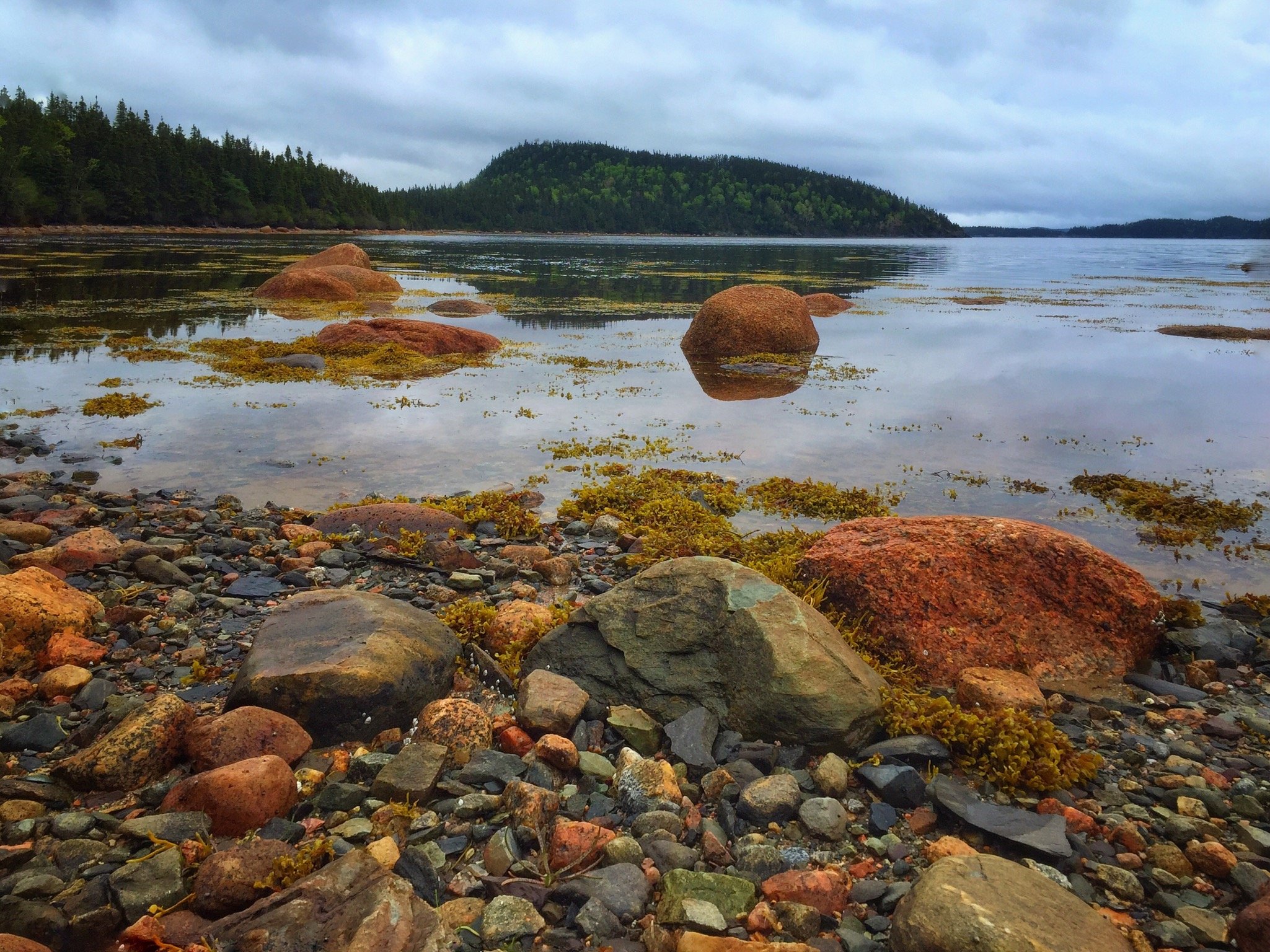
Rocks in Bay
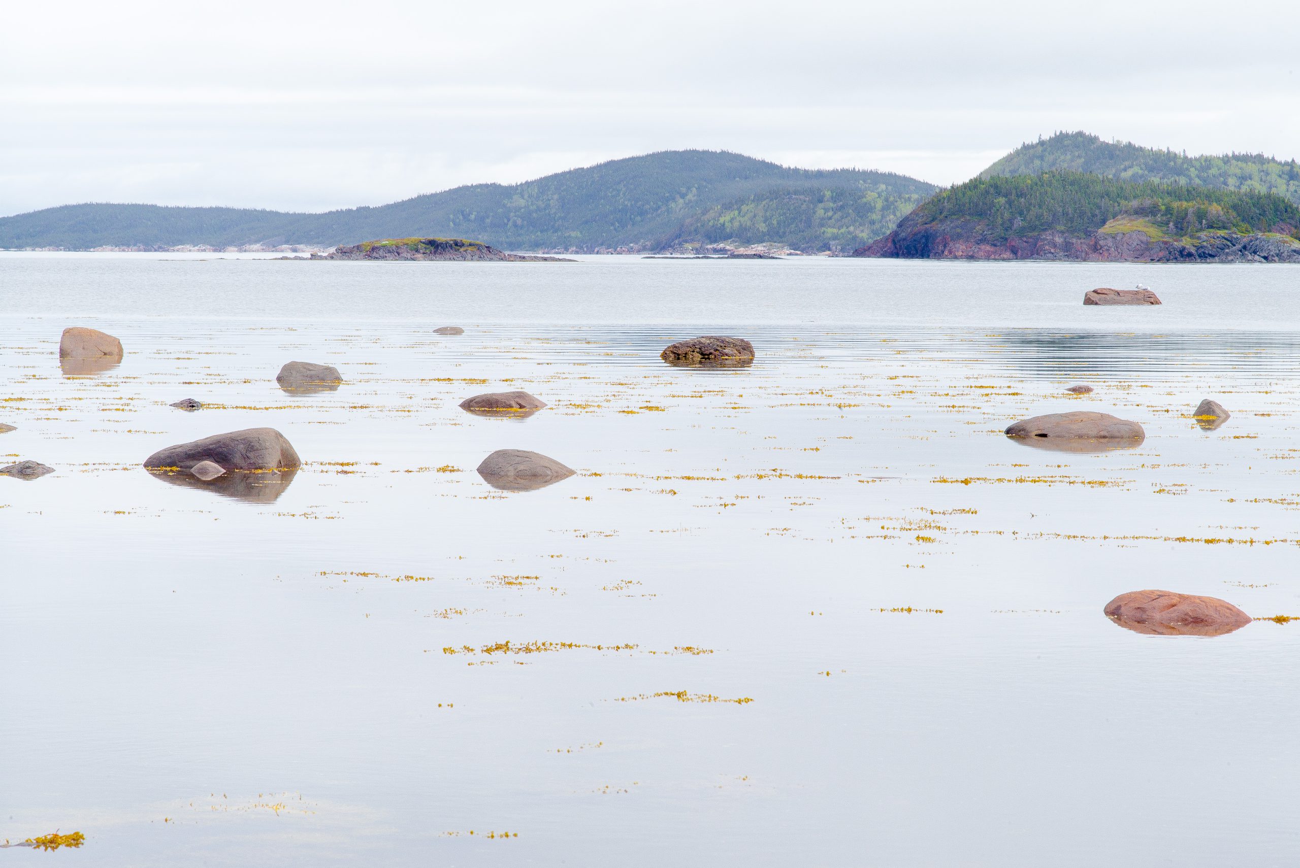
I took this shot because of the rocks in the quiet bay. The sea was still; reflections where present. The shape of the rocks mimicked the hills in the background; their spacing lent a simplifying quality to the pjhotograph.
-
Tree and Ice
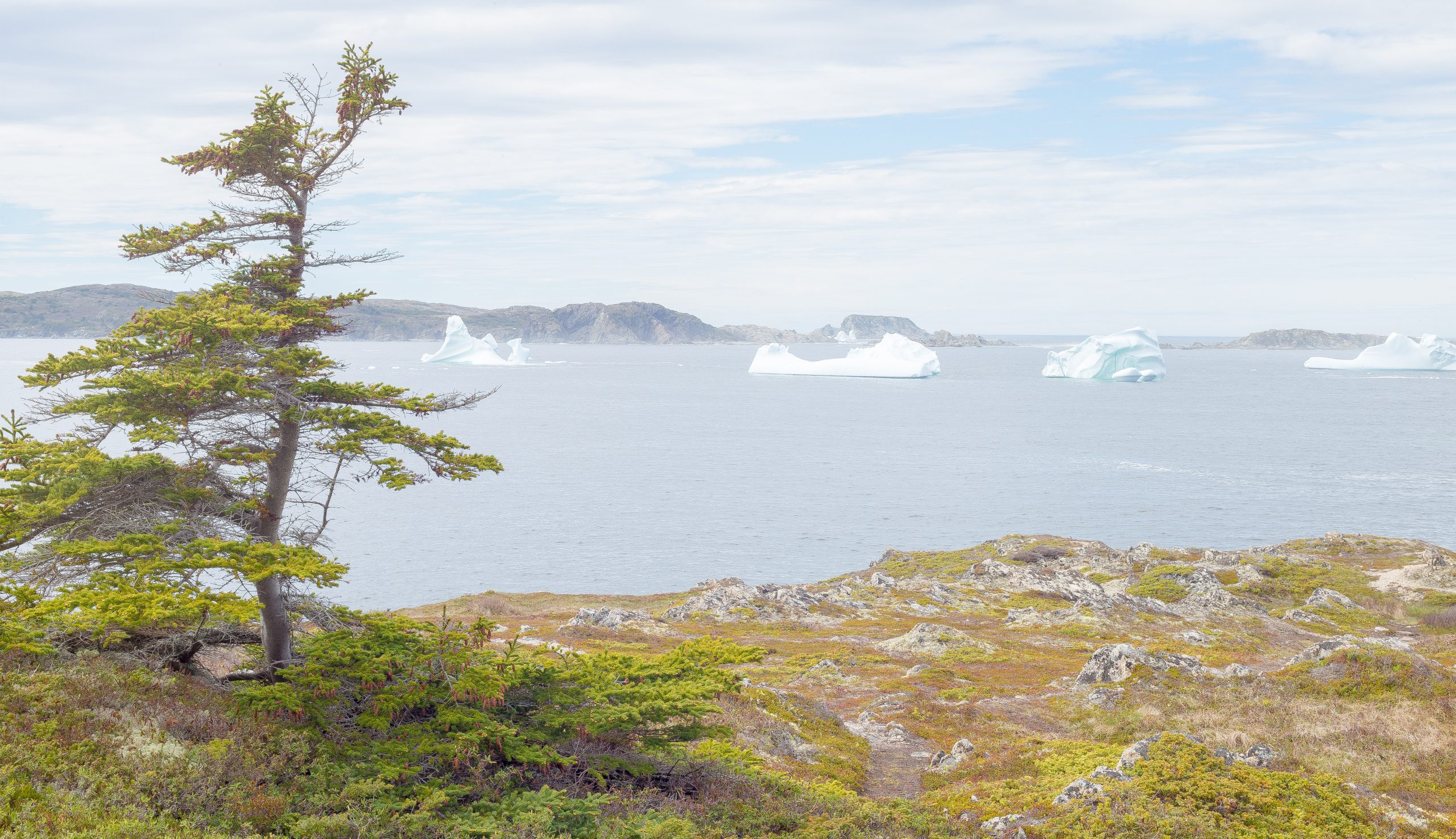
The shape of the tree first caught my attention, quickly followed by the parade of icebergs in the bay.
-
Warm Rocks
Again it was the light that caught my attention for this shot; that signalled it was time to shoot. It brought out the character, colour and detail of the rock.
-
Shed and Wharf
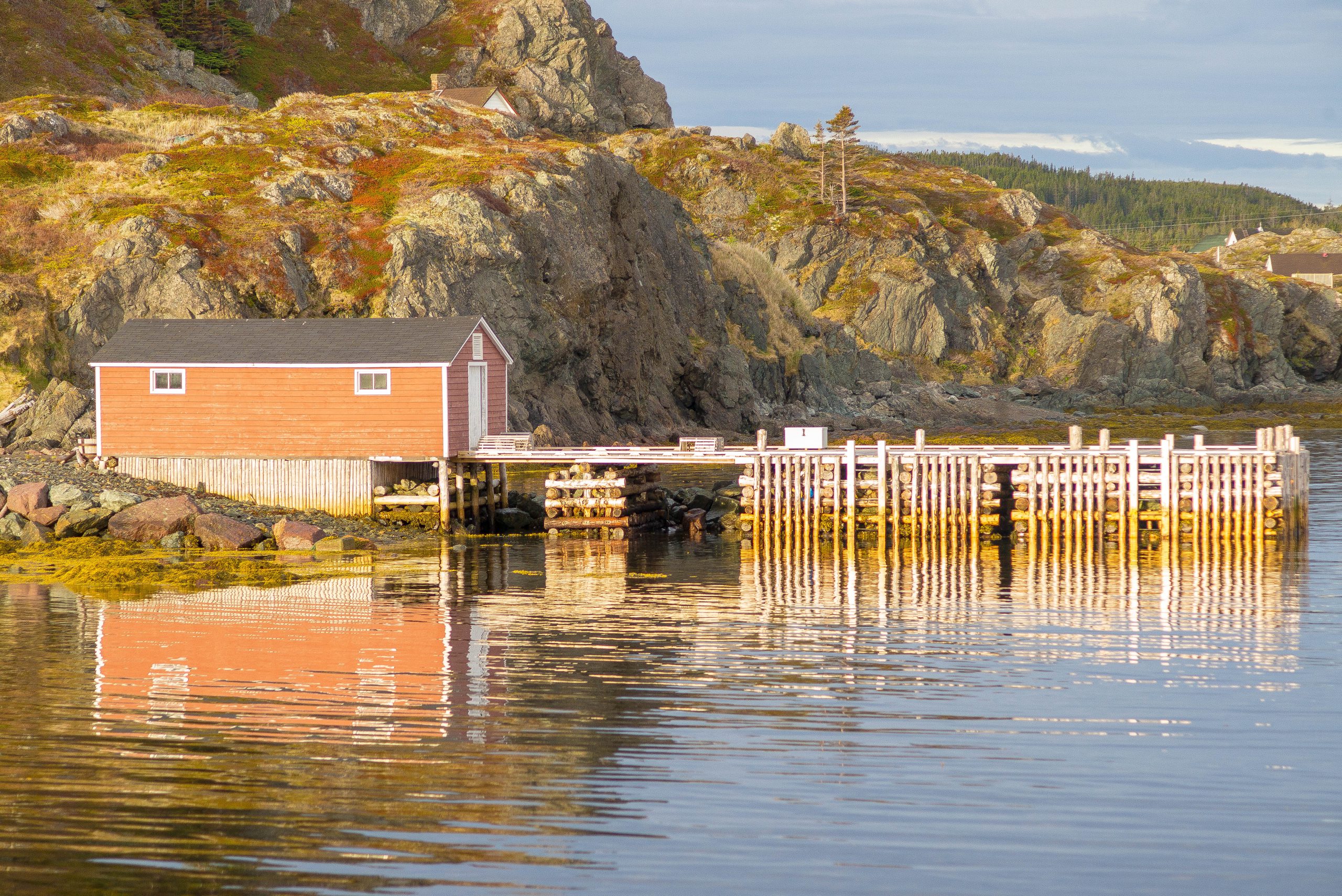
The light again warmed up this shot of a shed and seemed to bring out the texture and detail in the rock. The colour of the shed complemented the scene. The ripples in the water exposed interesting reflections of the structure.
-
Reflections
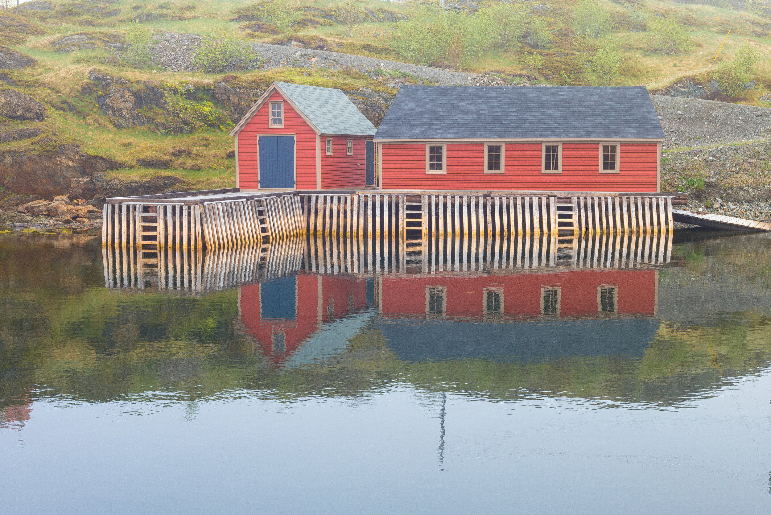
I took this shot because I liked the reflection in the bay, and the colour of the building.
-
Jurassic Park
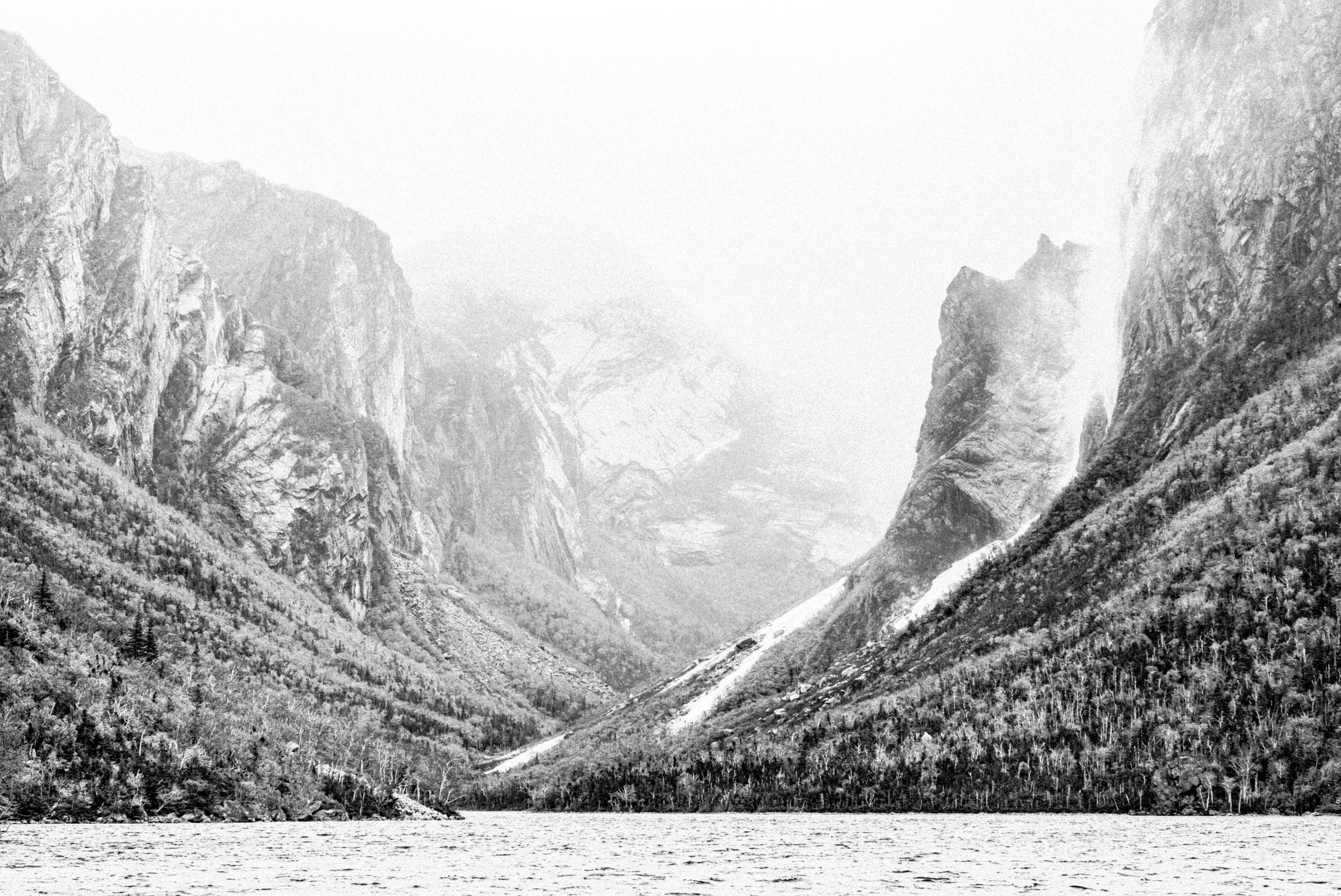
The whole sense of this place, Western Brook Pond, left me with a sense of prehistoric times. It was fortunate that the day was cloudy and foggy, as that added to the mystery. However, to capture the sense that was in my minds eye required a fair amount of post-processing, including: conversion to black and…